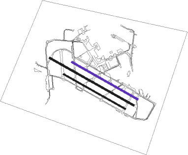
Sydney - Bankstown
Airport details
| Country | Australia |
| State | New South Wales |
| Region | YM |
| Airspace | Melbourne Ctr |
| Municipality | Sydney |
| Elevation | 26ft (8m) |
| Timezone | GMT +10 |
| Coordinates | -33.91721, 150.99722 |
| Magnetic var | |
| Type | land |
| Available since | X-Plane v10.35 |
| ICAO code | YSBK |
| IATA code | BWU |
| FAA code | n/a |
Communication
| Bankstown YSBK ATIS | 120.900 |
| Bankstown BANKSTOWN MULT | 132.800 |
| Bankstown BANKSTOWN Ground Control | 119.900 |
| Bankstown BANKSTOWN Tower | 123.600 |
| Bankstown BANKSTOWN Tower | 132.800 |
| Bankstown SYDNEY Approach | 128.300 |
| Bankstown SYDNEY Approach | 124.550 |
| Bankstown SYDNEY Departure | 118.400 |
| Bankstown SYDNEY Departure | 129.690 |
Nearby Points of Interest:
Bankstown Bunker
-The Homestead (Georges Hall)
-Lansdowne Bridge
-Lidcombe Hospital Precinct
-St Luke's Anglican Church, Liverpool
-St Anne's Roman Catholic Church, South Strathfield
-Auburn Railway Signal Box
-Electricity Substation No. 167
-Granville Town Hall
-Strathfield rail underbridges
-Burwood Sewer Vent
-Burwood rail underbridge
-Bethungra, Canterbury
-Essington
-88-92 George Street, Parramatta
-Newington Armory
-Parramatta Regional Park
-Prince Alfred Square
-Avondale, Parramatta
-Endrim
-Prospect Hill
-Yaralla Estate
-Dundas railway station
-Prospect Reservoir Valve House
-Parramatta Correctional Centre
Runway info
Nearby beacons
| code | identifier | dist | bearing | frequency |
|---|---|---|---|---|
| BK | BANKSTOWN (SYDNEY) NDB | 0.7 | 218° | 416 |
| SY | DME | 9.3 | 98° | 112.10 |
| RIC | RICHMOND TACAN | 21 | 327° | 110.70 |
| RIC | RICHMOND NDB | 22.1 | 325° | 347 |
| WOL | WOLLONGONG NDB | 39.8 | 198° | 239 |
Instrument approach procedures
| runway | airway (heading) | route (dist, bearing) |
|---|---|---|
| RW11C | RAKSO (68°) | RAKSO 3700ft SBKWI (13mi, 41°) 2500ft |
| RW11C | SBKWB (117°) | SBKWB 2500ft SBKWI (3mi, 133°) 2500ft |
| RNAV | SBKWI 2500ft SBKWF (3mi, 114°) 1460ft SBKWM (3mi, 114°) 344ft SBKWH (4mi, 349°) 1500ft (8201mi, 283°) 2500ft |
Disclaimer
The information on this website is not for real aviation. Use this data with the X-Plane flight simulator only! Data taken with kind consent from X-Plane 12 source code and data files. Content is subject to change without notice.

