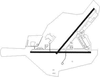
Nowra - Hmas Albatross
Airport details
| Country | Australia |
| State | New South Wales |
| Region | YM |
| Airspace | Melbourne Ctr |
| Municipality | Shoalhaven City Council |
| Elevation | 398ft (121m) |
| Timezone | GMT +10 |
| Coordinates | -34.95250, 150.53851 |
| Magnetic var | |
| Type | land |
| Available since | X-Plane v10.40 |
| ICAO code | YSNW |
| IATA code | NOA |
| FAA code | n/a |
Communication
| HMAS Albatross ACTIVATE LIGHTS ONLY MULT | 122.200 |
| HMAS Albatross MBZ MULT | 118.800 |
| HMAS Albatross MELBOURNE CENTRE MULT | 121.200 |
| HMAS Albatross NOWRA GROUND CLD | 121.750 |
| HMAS Albatross NOWRA CLD | 128.350 |
| HMAS Albatross NOWRA Ground Control | 135.850 |
| HMAS Albatross NOWRA Tower | 118.800 |
| HMAS Albatross NOWRA Approach | 135.950 |
| HMAS Albatross NOWRA Departure | 123.500 |
Approach frequencies
| ILS-cat-I | RW21 | 108.5 | 18.00mi |
| 3° GS | RW21 | 108.5 | 18.00mi |
Nearby Points of Interest:
Graham Lodge
-Bomaderry Aboriginal Children's Home
-MV Lady Denman
-St Stephen's Presbyterian Church, Jamberoo
-Kiama Masonic Temple
-Kiama railway station
-Bombo railway station
-Wingello railway station
-Mount Broughton
-Dunmore railway station
-Moss Vale railway station
-Tallong railway station
-Berrima Correctional Centre
-Christ Church Anglican Church, Bungonia
-Marulan railway station
-Mittagong railway station
Runway info
Runway 03 / 21  | ||
| length | 2052m (6732ft) | |
| bearing | 50° / 230° | |
| width | 45m (148ft) | |
| surface | asphalt | |
| blast zone | 0m (0ft) / 5m (16ft) | |
| Runway 08 / 26 | ||
| length | 2091m (6860ft) | |
| bearing | 94° / 274° | |
| width | 45m (148ft) | |
| surface | asphalt | |
| displ threshold | 0m (0ft) / 91m (299ft) | |
| blast zone | 19m (62ft) / 0m (0ft) | |
Nearby beacons
| code | identifier | dist | bearing | frequency |
|---|---|---|---|---|
| NWA | NOWRA TACAN | 0.2 | 295° | 116.40 |
| NWA | NOWRA NDB | 0.4 | 279° | 359 |
| WOL | WOLLONGONG NDB | 26.7 | 33° | 239 |
| GLB | GOULBURN NDB | 40.4 | 280° | 407 |
Departure and arrival routes
| Transition altitude | 10000ft |
| Transition level | 11000ft |
| SID end points | distance | outbound heading | |
|---|---|---|---|
| RW03 | |||
| TONTO4 | 40mi | 9° | |
| WOL4 | 27mi | 33° | |
| ABASS4 | 30mi | 48° | |
| URBOB2 | 60mi | 203° | |
| COM4 | 114mi | 228° | |
| GLB4 | 40mi | 280° | |
| AKMIR2 | 51mi | 331° | |
| RW08 | |||
| TONTO4 | 40mi | 9° | |
| WOL4 | 27mi | 33° | |
| ABASS4 | 30mi | 48° | |
| URBOB2 | 60mi | 203° | |
| COM4 | 114mi | 228° | |
| GLB4 | 40mi | 280° | |
| AKMIR2 | 51mi | 331° | |
| RW21 | |||
| TONTO4 | 40mi | 9° | |
| WOL4 | 27mi | 33° | |
| ABASS4 | 30mi | 48° | |
| URBOB2 | 60mi | 203° | |
| COM4 | 114mi | 228° | |
| GLB4 | 40mi | 280° | |
| AKMIR2 | 51mi | 331° | |
| RW26 | |||
| TONTO4 | 40mi | 9° | |
| WOL4 | 27mi | 33° | |
| ABASS4 | 30mi | 48° | |
| URBOB2 | 60mi | 203° | |
| COM4 | 114mi | 228° | |
| GLB4 | 40mi | 280° | |
| AKMIR2 | 51mi | 331° | |
Instrument approach procedures
| runway | airway (heading) | route (dist, bearing) |
|---|---|---|
| RW03 | SNWSK (21°) | SNWSK 4300ft SNWSI (4mi, 321°) 3190ft |
| RW03 | SNWSL (43°) | SNWSL 4300ft SNWSI (4mi, 42°) 3190ft |
| RW03 | SNWSN (63°) | SNWSN 4300ft SNWSI (4mi, 104°) 3190ft |
| RNAV | SNWSI 3190ft SNWSF (4mi, 42°) 1920ft SNWSM (4mi, 42°) 649ft SNWSH (3mi, 42°) (8142mi, 283°) 4300ft | |
| RW21 | SNWNA (209°) | SNWNA 4300ft SNWNI (4mi, 150°) 3090ft |
| RW21 | SNWNC (229°) | SNWNC 4300ft SNWNI (4mi, 230°) 3090ft |
| RW21 | SNWND (247°) | SNWND 4300ft SNWNI (4mi, 290°) 3090ft |
| RNAV | SNWNI 3090ft SNWNF (4mi, 230°) 1820ft SNWNM (4mi, 230°) 548ft SNWNH (3mi, 230°) (8138mi, 283°) 4300ft | |
| RW26 | SNWEE (256°) | SNWEE 4300ft SNWEI (4mi, 209°) 3080ft |
| RW26 | SNWEG (273°) | SNWEG 3080ft SNWEI (4mi, 274°) 3080ft |
| RW26 | SNWEJ (290°) | SNWEJ 3080ft SNWEI (4mi, 341°) 3080ft |
| RNAV | SNWEI 3080ft SNWEF (4mi, 274°) 1810ft SNWEM (4mi, 274°) 535ft SNWEH (3mi, 274°) (8138mi, 283°) 4300ft |
Disclaimer
The information on this website is not for real aviation. Use this data with the X-Plane flight simulator only! Data taken with kind consent from X-Plane 12 source code and data files. Content is subject to change without notice.