Richmond - Richmond (nsw)
Airport details
| Country | Australia |
| State | New South Wales |
| Region | YM |
| Airspace | Melbourne Ctr |
| Municipality | Sydney |
| Elevation | 64ft (20m) |
| Timezone | GMT +10 |
| Coordinates | -33.60056, 150.78084 |
| Magnetic var | |
| Type | land |
| Available since | X-Plane v10.40 |
| ICAO code | YSRI |
| IATA code | XRH |
| FAA code | n/a |
Communication
| Richmond (NSW) RICHMOND MULT | 135.500 |
| Richmond (NSW) RICHMOND Ground Control | 128.250 |
| Richmond (NSW) RICHMOND Ground Control | 121.650 |
| Richmond (NSW) BRISBANE CNTR | 133.050 |
| Richmond (NSW) RICHMOND Tower | 135.500 |
| Richmond (NSW) SYDNEY Approach | 135.900 |
| Richmond (NSW) SYDNEY Approach | 124.550 |
Approach frequencies
| ILS-cat-I | RW28 | 111.9 | 18.00mi |
| 3° GS | RW28 | 111.9 | 18.00mi |
Nearby Points of Interest:
126 Windsor Street, Richmond
-Richmond Post Office
-McQuade Park
-Loder House
-Rose Cottage, Wilberforce
-St John's Anglican Church and Macquarie Schoolhouse
-Cattai Estate
-Emu Plains Underbridge
-Imperial Hotel, Rooty Hill
-Lennox Bridge, Glenbrook
-Glenbrook Tunnel
-St Andrew's Anglican Church, Seven Hills
-Grantham Poultry Research Station
-St Paul's Anglican Church, Castle Hill
-Prospect Reservoir Valve House
-Prospect Hill
-Tunks Creek bridge, Galston
-Parramatta Correctional Centre
-St Patricks Cemetery, Parramatta
-Essington
-Parramatta Regional Park
-Avondale, Parramatta
-Prince Alfred Square
-Old Man's Valley Cemetery
-Endrim
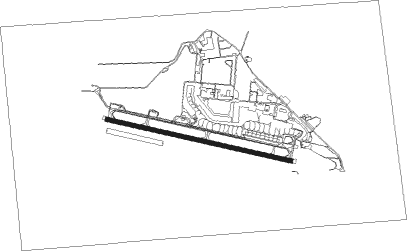
Runway info
| Runway 10 / 28 | ||
| length | 2132m (6995ft) | |
| bearing | 104° / 284° | |
| width | 45m (148ft) | |
| surface | asphalt | |
Nearby beacons
| code | identifier | dist | bearing | frequency |
|---|---|---|---|---|
| RIC | RICHMOND NDB | 0.3 | 309° | 347 |
| RIC | RICHMOND TACAN | 0.9 | 110° | 110.70 |
| BK | BANKSTOWN (SYDNEY) NDB | 22.2 | 148° | 416 |
| SY | DME | 28.7 | 131° | 112.10 |
| WOL | WOLLONGONG NDB | 57.4 | 179° | 239 |
| WMD | WEST MAITLAND NDB | 63.3 | 42° | 224 |
Departure and arrival routes
| Transition altitude | 10000ft |
| Transition level | 11000ft |
| SID end points | distance | outbound heading | |
|---|---|---|---|
| RW10 | |||
| SCO2 | 94mi | 2° | |
| ANKUB1 | 25mi | 153° | |
| KADOM1 | 25mi | 257° | |
| MUDGI2 | 86mi | 311° | |
| RW28 | |||
| SCO2 | 94mi | 2° | |
| ANKUB1 | 25mi | 153° | |
| KADOM1, KADOM2 | 25mi | 257° | |
| MUDGI2 | 86mi | 311° | |
Instrument approach procedures
| runway | airway (heading) | route (dist, bearing) |
|---|---|---|
| RW10 | XRHWD (86°) | XRHWD 5000ft XRHWI (5mi, 42°) 3930ft |
| RW10 | XRHWE (104°) | XRHWE 5000ft XRHWI (5mi, 105°) 3930ft |
| RW10 | XRHWG (122°) | XRHWG 5000ft XRHWI (5mi, 177°) 3930ft |
| RNAV | XRHWI 3930ft XRHWF (3mi, 105°) 2630ft XRHWM (6mi, 105°) 214ft (8205mi, 283°) 570ft XRHWH (8214mi, 103°) (8214mi, 283°) 5000ft | |
| RW28 | SRIEA (271°) | SRIEA 2500ft SRIEI (3mi, 200°) 2500ft |
| RW28 | SRIEB (300°) | SRIEB 2500ft SRIEI (3mi, 20°) 2500ft |
| RNAV | SRIEI 2500ft SRIEF (4mi, 284°) 1780ft SRIEM (5mi, 284°) 188ft (8206mi, 283°) 570ft SRIEH (8211mi, 103°) (8211mi, 283°) 2500ft |
Disclaimer
The information on this website is not for real aviation. Use this data with the X-Plane flight simulator only! Data taken with kind consent from X-Plane 12 source code and data files. Content is subject to change without notice.