Tumbarumba
Airport details
| Country | Australia |
| State | New South Wales |
| Region | YM |
| Airspace | Melbourne Ctr |
| Municipality | Snowy Valleys Council |
| Elevation | 1993ft (607m) |
| Timezone | GMT +11 |
| Coordinates | -35.76796, 147.88583 |
| Magnetic var | |
| Type | land |
| Available since | X-Plane v10.40 |
| ICAO code | YTBM |
| IATA code | n/a |
| FAA code | n/a |
Communication
Nearby Points of Interest:
Snowy Mountains Scheme
-Tumut Post Office
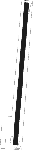
Runway info
| Runway 1 / 19 | ||
| length | 1241m (4072ft) | |
| bearing | 11° / 191° | |
| width | 40m (131ft) | |
| surface | grass | |
Nearby beacons
| code | identifier | dist | bearing | frequency |
|---|---|---|---|---|
| WG | WAGGA WAGGA VOR/DME | 41.5 | 325° | 115 |
| WG | WAGGA WAGGA NDB | 41.9 | 325° | 221 |
| AY | ALBURY VOR/DME | 48.2 | 252° | 115.60 |
Disclaimer
The information on this website is not for real aviation. Use this data with the X-Plane flight simulator only! Data taken with kind consent from X-Plane 12 source code and data files. Content is subject to change without notice.