Tumut
Airport details
| Country | Australia |
| State | New South Wales |
| Region | YM |
| Airspace | Melbourne Ctr |
| Municipality | Snowy Valleys Council |
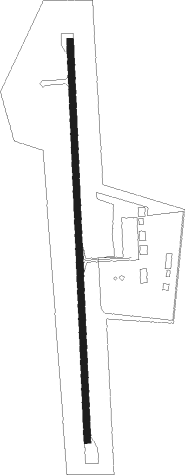
| Elevation | 875ft (267m) |
| Timezone | GMT +11 |
| Coordinates | -35.26278, 148.24083 |
| Magnetic var | |
| Type | land |
| Available since | X-Plane v10.40 |
| ICAO code | YTMU |
| IATA code | TUM |
| FAA code | n/a |
Communication
| Tumut TUMUT MULT | 126.700 |
| Tumut MELBOURNE CNTR | 119.500 |
Nearby Points of Interest:
Tumut railway station
-Tumut Post Office
-Murrumbidgee River railway bridge, Gundagai
-Prince Alfred Bridge
-Burrinjuck Dam
-Wee Jasper Bridge over Goodradigbee River
-Bimberi Nature Reserve
Nearby beacons
| code | identifier | dist | bearing | frequency |
|---|---|---|---|---|
| WG | WAGGA WAGGA VOR/DME | 38.3 | 277° | 115 |
| WG | WAGGA WAGGA NDB | 38.9 | 277° | 221 |
| CB | CANBERRA VOR/DME | 46.8 | 91° | 116.70 |
| CB | CANBERRA NDB | 47.4 | 92° | 263 |
Instrument approach procedures
| runway | airway (heading) | route (dist, bearing) |
|---|---|---|
| RWNVS | TMUSA (21°) | TMUSA 6900ft TMUSI (4mi, 93°) 6240ft |
| RWNVS | TMUSB (8°) | TMUSB 6900ft TMUSI (4mi, 29°) 6240ft |
| RWNVS | TMUSC (351°) | TMUSC 6900ft TMUSI (4mi, 308°) 6240ft |
| RNAV | TMUSI 6240ft TMUSF (4mi, 29°) 4800ft TMUSM (10mi, 353°) 1184ft TMUST (9mi, 324°) TMUSA (21mi, 179°) 6900ft |
Disclaimer
The information on this website is not for real aviation. Use this data with the X-Plane flight simulator only! Data taken with kind consent from X-Plane 12 source code and data files. Content is subject to change without notice.