Tocumwal
Airport details
| Country | Australia |
| State | New South Wales |
| Region | YM |
| Airspace | Melbourne Ctr |
| Municipality | Tocumwal |
| Elevation | 372ft (113m) |
| Timezone | GMT +11 |
| Coordinates | -35.81083, 145.60417 |
| Magnetic var | |
| Type | land |
| Available since | X-Plane v10.40 |
| ICAO code | YTOC |
| IATA code | TCW |
| FAA code | n/a |
Communication
| Tocumwal CTAF | 125.500 |
Nearby Points of Interest:
World War II Aeroplane Hangar, Tocumwal
-Murray River road and railway bridge, Tocumwal
-Tocumwal railway station
-Old Cobram-Barooga Bridge
-Finley Pioneer Railway Station
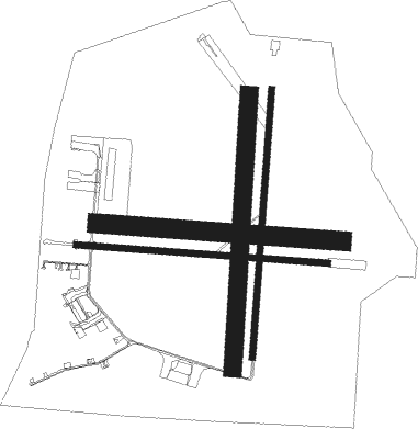
Runway info
Runway 09 / 27  | ||
| length | 1200m (3937ft) | |
| bearing | 97° / 277° | |
| width | 30m (98ft) | |
| surface | asphalt | |
| Runway 18 / 36 | ||
| length | 1278m (4193ft) | |
| bearing | 190° / 10° | |
| width | 30m (98ft) | |
| surface | asphalt | |
| blast zone | 165m (541ft) / 0m (0ft) | |
| Runway 18R / 36L | ||
| length | 1302m (4272ft) | |
| bearing | 190° / 10° | |
| width | 85m (279ft) | |
| surface | grass | |
| Runway 09L / 27R | ||
| length | 1168m (3832ft) | |
| bearing | 97° / 277° | |
| width | 90m (295ft) | |
| surface | grass | |
Nearby beacons
| code | identifier | dist | bearing | frequency |
|---|---|---|---|---|
| COR | COROWA NDB | 38.1 | 103° | 380 |
| SHT | SHEPPARTON NDB | 38.4 | 199° | 212 |
Instrument approach procedures
| runway | airway (heading) | route (dist, bearing) |
|---|---|---|
| RW09 | TOCWD (80°) | TOCWD 2100ft TOCWI (5mi, 34°) 2100ft |
| RW09 | TOCWE (97°) | TOCWE 2100ft TOCWI (5mi, 97°) 2100ft |
| RW09 | TOCWG (115°) | TOCWG 2100ft TOCWI (5mi, 166°) 2100ft |
| RNAV | TOCWI 2100ft TOCWF (5mi, 97°) 2100ft TOCWM (5mi, 97°) 501ft TOCWH (3mi, 97°) (7929mi, 284°) 2000ft | |
| RW27 | TOCEA (260°) | TOCEA 2100ft TOCEI (5mi, 214°) 2100ft |
| RW27 | TOCEB (277°) | TOCEB 2100ft TOCEI (5mi, 277°) 2100ft |
| RW27 | TOCEC (295°) | TOCEC 2100ft TOCEI (5mi, 346°) 2100ft |
| RNAV | TOCEI 2100ft TOCEF (5mi, 277°) 2100ft TOCEM (5mi, 277°) 508ft TOCEH (3mi, 277°) (7926mi, 284°) 2000ft |
Disclaimer
The information on this website is not for real aviation. Use this data with the X-Plane flight simulator only! Data taken with kind consent from X-Plane 12 source code and data files. Content is subject to change without notice.