Beverley - West Beverley
Airport details
| Country | Australia |
| State | Western Australia |
| Region | YM |
| Airspace | Melbourne Ctr |
| Municipality | Shire Of Beverley |
| Elevation | 952ft (290m) |
| Timezone | GMT +8 |
| Coordinates | -32.13742, 116.73294 |
| Magnetic var | |
| Type | land |
| Available since | X-Plane v10.40 |
| ICAO code | YWBV |
| IATA code | n/a |
| FAA code | n/a |
Communication
| West Beverley CTAF | 126.850 |
Nearby Points of Interest:
Avondale Agricultural Research Station
-Gwambygine Homestead
-Eliza's Cottage
-Old York Hospital
-York railway station
-York Town Hall
-St Patrick's Catholic Church, York
-York Primary School
-York Post Office
-York Fire Station
-Dinsdale's Shoe Emporium
-York Swing Bridge
-Marwick's Shed
-Northam Post Office
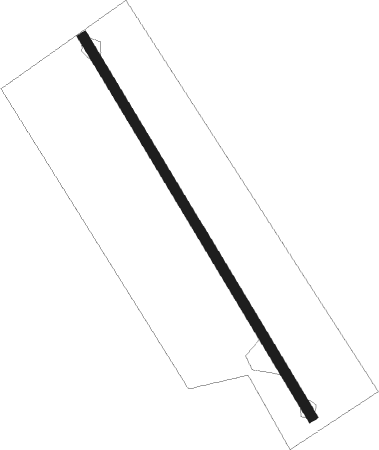
Runway info
| Runway 16 / 34 | ||
| length | 789m (2589ft) | |
| bearing | 150° / 330° | |
| width | 18m (59ft) | |
| surface | grass | |
Nearby beacons
| code | identifier | dist | bearing | frequency |
|---|---|---|---|---|
| CUN | CUNDERDIN NDB | 39.6 | 44° | 293 |
| PH | PERTH VOR/DME | 41 | 284° | 113.70 |
| JT | JANDAKOT NDB | 43 | 272° | 281 |
| PEA | PEARCE TACAN | 45.8 | 303° | 112.80 |
| PEA | PEARCE NDB | 46.5 | 304° | 340 |
| GIG | GINGIN NDB | 60.1 | 308° | 372 |
Disclaimer
The information on this website is not for real aviation. Use this data with the X-Plane flight simulator only! Data taken with kind consent from X-Plane 12 source code and data files. Content is subject to change without notice.