Walcha
Airport details
| Country | Australia |
| State | New South Wales |
| Region | YB |
| Airspace | Brisbane Ctr |
| Municipality | Walcha |
| Elevation | 3788ft (1155m) |
| Timezone | GMT +11 |
| Coordinates | -31.00708, 151.55534 |
| Magnetic var | |
| Type | land |
| Available since | X-Plane v10.40 |
| ICAO code | YWCH |
| IATA code | WLC |
| FAA code | n/a |
Communication
Nearby Points of Interest:
St. Andrew's Anglican Church
-Walcha Road railway station
-Macdonald River railway bridge, Woolbrook
-Captain Thunderbolt's Rock
-Captain Thunderbolt's death site
-Uralla railway station
-Captain Thunderbolt's Grave
-Roseneath, Armidale
-Armidale Post Office
-Commercial Bank of Australia Building, Armidale
-Booloominbah
-Dumaresq railway station
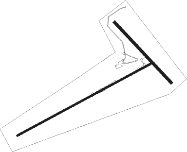
Runway info
Runway 14 / 32  | ||
| length | 852m (2795ft) | |
| bearing | 137° / 317° | |
| width | 30m (98ft) | |
| surface | grass | |
| Runway 6 / 24 | ||
| length | 1560m (5118ft) | |
| bearing | 69° / 249° | |
| width | 20m (66ft) | |
| surface | dirt | |
Nearby beacons
| code | identifier | dist | bearing | frequency |
|---|---|---|---|---|
| ARM | ARMIDALE NDB | 28.9 | 7° | 401 |
| TW | TAMWORTH NDB | 37.4 | 265° | 341 |
Disclaimer
The information on this website is not for real aviation. Use this data with the X-Plane flight simulator only! Data taken with kind consent from X-Plane 12 source code and data files. Content is subject to change without notice.