Williamtown
Airport details
| Country | Australia |
| State | New South Wales |
| Region | YB |
| Airspace | Brisbane Ctr |
| Municipality | Port Stephens Council |
| Elevation | 27ft (8m) |
| Timezone | GMT +10 |
| Coordinates | -32.79500, 151.83444 |
| Magnetic var | |
| Type | land |
| Available since | X-Plane v10.40 |
| ICAO code | YWLM |
| IATA code | NTL |
| FAA code | n/a |
Communication
| Williamtown ATIS | 125.700 |
| Williamtown CTAF | 118.300 |
| Williamtown Clearance DEL | 130.350 |
| Williamtown Ground Control | 121.800 |
| Williamtown Tower | 118.300 |
| Williamtown WILLY Approach | 135.700 |
| Williamtown WILLY Departure | 135.700 |
Approach frequencies
| ILS-cat-I | RW12 | 110.5 | 18.00mi |
| 3° GS | RW12 | 110.5 | 18.00mi |
Nearby Points of Interest:
No. 131 Radar Station RAAF
-Nobbys Head Light
-Carrington Pump House
-Newcastle railway station
-Earp Gillam Bond Store
-T & G Mutual Life Assurance Building
-Manufacturers House
-Church and Watt Street Terrace Group
-Victoria Theatre
-Newcastle Court House
-University House
-Castlemaine Brewery
-Bogey Hole
-Shepherds Hill military installations
-Broadmeadow Locomotive Depot
-Hinton Bridge over Paterson River
-Morpeth Bridge
-St James' Anglican Church, Morpeth
-Goonoobah
-East Maitland Post Office
-Clarence Town Bridge over Williams River
-Caroline Chisholm Cottage
-Smith's Flour Mill (former)
-Maitland Town Hall
-Maitland Lodge of Unity Masonic Hall and Lodge
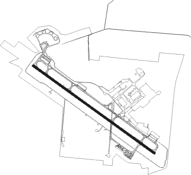
Runway info
| Runway 12 / 30 | ||
| length | 3061m (10043ft) | |
| bearing | 126° / 306° | |
| width | 45m (148ft) | |
| surface | asphalt | |
| displ threshold | 281m (922ft) / 0m (0ft) | |
| blast zone | 60m (197ft) / 60m (197ft) | |
Nearby beacons
| code | identifier | dist | bearing | frequency |
|---|---|---|---|---|
| WLM | WILLIAMTOWN (NEWCASTLE) TACAN | 0.1 | 212° | 113.30 |
| WLM | WILLIAMTOWN (NEWCASTLE) NDB | 0.5 | 214° | 365 |
| WMD | WEST MAITLAND NDB | 15.4 | 278° | 224 |
Departure and arrival routes
| Transition altitude | 10000ft |
| Transition level | 11000ft |
| SID end points | distance | outbound heading | |
|---|---|---|---|
| RW12 | |||
| OMBU1B, OMBU1A | 15mi | 12° | |
| LATU1A, LATU1B | 21mi | 28° | |
| WONK1B, WONK1A | 25mi | 37° | |
| EGEVO1 | 15mi | 174° | |
| BUBR1A, BUBR1B | 15mi | 328° | |
| GUTE1B, GUTE1A | 15mi | 353° | |
| RW30 | |||
| OMBUP1 | 15mi | 12° | |
| LATUT1 | 21mi | 28° | |
| WONKA1 | 25mi | 37° | |
| EGEVO1 | 15mi | 174° | |
| BUBRI1 | 15mi | 328° | |
| GUTEX1 | 15mi | 353° | |
Instrument approach procedures
| runway | airway (heading) | route (dist, bearing) |
|---|---|---|
| RW12 | WM2WA (106°) | WM2WA 3100ft WM2WI (5mi, 64°) 3100ft |
| RW12 | WM2WB (126°) | WM2WB 3100ft WM2WI (5mi, 126°) 3100ft |
| RW12 | WM2WC (147°) | WM2WC 3100ft WM2WI (5mi, 204°) 3100ft |
| RNAV | WM2WI 3100ft WM2WF (5mi, 126°) 1610ft YWLM (6mi, 125°) 79ft WM2WH (2mi, 126°) (8277mi, 282°) 3100ft | |
| RW30 | WM2ED (287°) | WM2ED 3100ft WM2EI (5mi, 244°) 3100ft |
| RW30 | WM2EE (306°) | WM2EE 3100ft WM2EI (5mi, 305°) 3100ft |
| RW30 | WM2EG (327°) | WM2EG 3100ft WM2EI (5mi, 24°) 3100ft |
| RNAV | WM2EI 3100ft WM2EF (5mi, 306°) 1590ft YWLM (6mi, 306°) 66ft WM2EH (2mi, 305°) (8277mi, 282°) 3100ft |
Disclaimer
The information on this website is not for real aviation. Use this data with the X-Plane flight simulator only! Data taken with kind consent from X-Plane 12 source code and data files. Content is subject to change without notice.