West Wyalong
Airport details
| Country | Australia |
| State | New South Wales |
| Region | YM |
| Airspace | Melbourne Ctr |
| Municipality | West Wyalong |
| Elevation | 855ft (261m) |
| Timezone | GMT +11 |
| Coordinates | -33.93667, 147.19167 |
| Magnetic var | |
| Type | land |
| Available since | X-Plane v10.40 |
| ICAO code | YWWL |
| IATA code | WWY |
| FAA code | n/a |
Communication
| West Wyalong ACTIVATE LIGHTS ONLY MULT | 122.300 |
| West Wyalong WEST WYALONG MULT | 126.700 |
| West Wyalong MELBOURNE CNTR | 126.000 |
Nearby Points of Interest:
Narrandera railway station
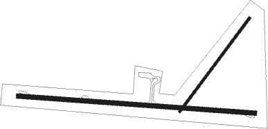
Runway info
Runway 09 / 27  | ||
| length | 1581m (5187ft) | |
| bearing | 97° / 277° | |
| width | 30m (98ft) | |
| surface | asphalt | |
| Runway 04 / 22 | ||
| length | 776m (2546ft) | |
| bearing | 47° / 227° | |
| width | 18m (59ft) | |
| surface | gravel | |
Instrument approach procedures
| runway | airway (heading) | route (dist, bearing) |
|---|---|---|
| RW27-Z | WWLEA (260°) | WWLEA 2800ft WWLEI (5mi, 213°) 2800ft |
| RW27-Z | WWLEB (278°) | WWLEB 2800ft WWLEI (5mi, 277°) 2800ft |
| RW27-Z | WWLEC (296°) | WWLEC 2800ft WWLEI (5mi, 346°) 2800ft |
| RNAV | WWLEI 2800ft WWLEF (5mi, 277°) 2570ft WWLEM (5mi, 277°) 977ft WWLEH (3mi, 277°) (8059mi, 283°) 2800ft | |
| RWNVW | WWLWD (79°) | WWLWD 2800ft WWLWI (5mi, 33°) 2800ft |
| RWNVW | WWLWE (97°) | WWLWE 2800ft WWLWI (5mi, 97°) 2800ft |
| RWNVW | WWLWG (114°) | WWLWG 2800ft WWLWI (5mi, 166°) 2800ft |
| RNAV | WWLWI 2800ft WWLWF (5mi, 97°) 2590ft WWLWM (5mi, 97°) 994ft WWLWH (3mi, 97°) (8062mi, 283°) 2800ft |
Disclaimer
The information on this website is not for real aviation. Use this data with the X-Plane flight simulator only! Data taken with kind consent from X-Plane 12 source code and data files. Content is subject to change without notice.