Wyandra
Airport details
| Country | Australia |
| State | Queensland |
| Region | YB |
| Airspace | Brisbane Ctr |
| Municipality | Paroo Shire |
| Elevation | 798ft (243m) |
| Timezone | GMT +10 |
| Coordinates | -27.26667, 145.99001 |
| Magnetic var | |
| Type | land |
| Available since | X-Plane v10.40 |
| ICAO code | YWYA |
| IATA code | n/a |
| FAA code | n/a |
Communication
| Wyandra CTAF | 126.700 |
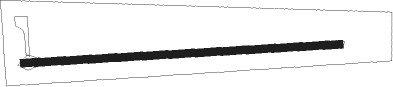
Runway info
| Runway 09 / 27 | ||
| length | 1284m (4213ft) | |
| bearing | 91° / 271° | |
| width | 30m (98ft) | |
| surface | dirt | |
Nearby beacons
| code | identifier | dist | bearing | frequency |
|---|---|---|---|---|
| CMU | CUNNAMULLA NDB | 50 | 205° | 218 |
| CV | CHARLEVILLE NDB | 52.7 | 17° | 269 |
Disclaimer
The information on this website is not for real aviation. Use this data with the X-Plane flight simulator only! Data taken with kind consent from X-Plane 12 source code and data files. Content is subject to change without notice.