Yarrawonga
Airport details
| Country | Australia |
| State | Victoria |
| Region | YM |
| Airspace | Melbourne Ctr |
| Municipality | Yarrawonga |
| Elevation | 417ft (127m) |
| Timezone | GMT +11 |
| Coordinates | -36.03056, 146.02777 |
| Magnetic var | |
| Type | land |
| Available since | X-Plane v10.40 |
| ICAO code | YYWG |
| IATA code | n/a |
| FAA code | n/a |
Communication
| Yarrawonga CTAF | 126.700 |
Nearby Points of Interest:
Corowa railway station
-Corowa Courthouse
-All Saints Estate Winery
-Old Cobram-Barooga Bridge
-World War II Aeroplane Hangar, Tocumwal
-Murray River road and railway bridge, Tocumwal
-Tocumwal railway station
-Finley Pioneer Railway Station
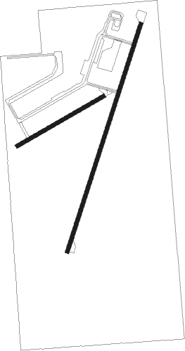
Runway info
Runway 01 / 19  | ||
| length | 1145m (3757ft) | |
| bearing | 27° / 207° | |
| width | 18m (59ft) | |
| surface | asphalt | |
| displ threshold | 0m (0ft) / 16m (52ft) | |
| Runway 05 / 23 | ||
| length | 478m (1568ft) | |
| bearing | 69° / 249° | |
| width | 18m (59ft) | |
| surface | dirt | |
Nearby beacons
| code | identifier | dist | bearing | frequency |
|---|---|---|---|---|
| COR | COROWA NDB | 16.2 | 83° | 380 |
| SHT | SHEPPARTON NDB | 38.8 | 238° | 212 |
| AY | ALBURY VOR/DME | 45.6 | 92° | 115.60 |
| MNG | MANGALORE VOR | 65.2 | 224° | 113.20 |
Instrument approach procedures
| runway | airway (heading) | route (dist, bearing) |
|---|---|---|
| RW19-Z | YWGND (182°) | YWGND 3500ft YWGNI (5mi, 127°) 3500ft |
| RW19-Z | YWGNE (207°) | YWGNE 3500ft YWGNI (5mi, 207°) 3500ft |
| RW19-Z | YWGNG (229°) | YWGNG 3500ft YWGNI (5mi, 272°) 3500ft |
| RNAV | YWGNI 3500ft YWGNF (5mi, 207°) 2150ft YWGNM (5mi, 207°) 560ft YWGNH (3mi, 207°) (7932mi, 284°) 3000ft |
Disclaimer
The information on this website is not for real aviation. Use this data with the X-Plane flight simulator only! Data taken with kind consent from X-Plane 12 source code and data files. Content is subject to change without notice.