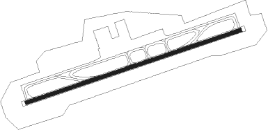
Dayong - Zhangjiajie Hehua
Airport details
| Country | China |
| State | Hunan |
| Region | ZG |
| Airspace | Guangzhou Ctr |
| Municipality | Zhangjiajie |
| Elevation | 668ft (204m) |
| Timezone | GMT +8 |
| Coordinates | 29.10167, 110.44500 |
| Magnetic var | |
| Type | land |
| Available since | X-Plane v10.40 |
| ICAO code | ZGDY |
| IATA code | DYG |
| FAA code | n/a |
Communication
Approach frequencies
| ILS-cat-I | RW26 | 108.9 | 18.00mi |
| ILS-cat-I | RW08 | 109.7 | 18.00mi |
| 3.2° GS | RW26 | 108.9 | 18.00mi |
| 3.2° GS | RW08 | 109.7 | 18.00mi |
Nearby Points of Interest:
Puguang Temple
-Tusi Sites
-Xizhou Tongzhu
Nearby beacons
| code | identifier | dist | bearing | frequency |
|---|---|---|---|---|
| P | HEHUA (ZHANGJIAJIE) NDB | 1.3 | 74° | 384 |
| D | HEHUA (ZHANGJIAJIE) NDB | 1.4 | 261° | 308 |
| DYG | ZHANGJIAJIE VOR/DME | 2.1 | 258° | 114.40 |
| JX | YINJIAXI NDB | 5.3 | 331° | 319 |
| PS | HEHUA (ZHANGJIAJIE) NDB | 6.8 | 77° | 278 |
| HUY | HUAYUAN VOR/DME | 61 | 242° | 112 |
Departure and arrival routes
| Transition altitude | 9843ft |
| Transition level | 11811ft |
| SID end points | distance | outbound heading | |
|---|---|---|---|
| RW08 | |||
| LIN07D, LIN01D | 65mi | 78° | |
| KAL07D, KAL01D | 61mi | 78° | |
| LLC07D, LLC01D | 112mi | 120° | |
| HUY07D, HUY01D | 61mi | 242° | |
| ENH01D, ENH07D | 84mi | 325° | |
| RW26 | |||
| LIN17D, LIN11D | 65mi | 78° | |
| KAL17D, KAL11D | 61mi | 78° | |
| LLC11D, LLC17D | 112mi | 120° | |
| HUY17D, HUY11D | 61mi | 242° | |
| ENH17D, ENH11D | 84mi | 325° | |
| STAR starting points | distance | inbound heading | |
|---|---|---|---|
| RW08 | |||
| HUY03A, HUY07A, HUY06A, HUY02A, HUY01A | 61.0 | 62° | |
| ENH07A, ENH06A, ENH01A, ENH03A, ENH02A | 83.9 | 145° | |
| LIN07A, LIN02A, LIN01A | 64.8 | 258° | |
| KAL02A, KAL01A | 61.1 | 258° | |
| LLC07A, LLC02A, LLC01A | 111.7 | 300° | |
| RW26 | |||
| HUY17A, HUY12A, HUY11A | 61.0 | 62° | |
| ENH16A, ENH17A, ENH13A, ENH12A, ENH11A | 83.9 | 145° | |
| LIN17A, LIN16A, LIN13A, LIN12A, LIN11A | 64.8 | 258° | |
| KAL13A, KAL12A, KAL11A | 61.1 | 258° | |
| LLC17A, LLC16A, LLC12A, LLC11A | 111.7 | 300° | |
Holding patterns
| STAR name | hold at | type | turn | heading* | altitude | leg | speed limit |
|---|---|---|---|---|---|---|---|
| ENH02A | JX | FIX | right | 69 (249)° | > 5910ft | 1.0min timed | ICAO rules |
| ENH03A | DYG | NDB | right | 107 (287)° | > 6890ft | 1.0min timed | ICAO rules |
| ENH07A | JX001 | VHF | right | 88 (268)° | > 5910ft | 1.0min timed | 220 |
| ENH12A | JX | FIX | right | 69 (249)° | > 5910ft | 1.0min timed | ICAO rules |
| ENH13A | DYG | NDB | right | 107 (287)° | > 6890ft | 1.0min timed | ICAO rules |
| ENH17A | JX001 | VHF | right | 88 (268)° | > 5910ft | 1.0min timed | 220 |
| HUY02A | JX | FIX | right | 69 (249)° | > 5910ft | 1.0min timed | ICAO rules |
| HUY03A | DYG | NDB | right | 107 (287)° | > 6890ft | 1.0min timed | ICAO rules |
| HUY07A | JX001 | VHF | right | 88 (268)° | > 5910ft | 1.0min timed | 220 |
| HUY11A | DYG | NDB | right | 107 (287)° | > 6890ft | 1.0min timed | ICAO rules |
| HUY12A | JX | FIX | right | 69 (249)° | > 5910ft | 1.0min timed | ICAO rules |
| HUY17A | JX001 | VHF | right | 88 (268)° | > 5910ft | 1.0min timed | 220 |
| KAL01A | DYG | NDB | right | 107 (287)° | > 6890ft | 1.0min timed | ICAO rules |
| KAL02A | JX | FIX | right | 69 (249)° | > 5910ft | 1.0min timed | ICAO rules |
| KAL12A | JX | FIX | right | 69 (249)° | > 5910ft | 1.0min timed | ICAO rules |
| KAL13A | DYG | NDB | right | 107 (287)° | > 6890ft | 1.0min timed | ICAO rules |
| LIN01A | DYG | NDB | right | 107 (287)° | > 6890ft | 1.0min timed | ICAO rules |
| LIN02A | JX | FIX | right | 69 (249)° | > 5910ft | 1.0min timed | ICAO rules |
| LIN07A | JX001 | VHF | right | 88 (268)° | > 5910ft | 1.0min timed | 220 |
| LIN12A | JX | FIX | right | 69 (249)° | > 5910ft | 1.0min timed | ICAO rules |
| LIN13A | DYG | NDB | right | 107 (287)° | > 6890ft | 1.0min timed | ICAO rules |
| LIN17A | JX001 | VHF | right | 88 (268)° | > 5910ft | 1.0min timed | 220 |
| LLC01A | DYG | NDB | right | 107 (287)° | > 6890ft | 1.0min timed | ICAO rules |
| LLC02A | JX | FIX | right | 69 (249)° | > 5910ft | 1.0min timed | ICAO rules |
| LLC07A | JX001 | VHF | right | 88 (268)° | > 5910ft | 1.0min timed | 220 |
| LLC11A | DYG | NDB | right | 107 (287)° | > 6890ft | 1.0min timed | ICAO rules |
| LLC12A | JX | FIX | right | 69 (249)° | > 5910ft | 1.0min timed | ICAO rules |
| LLC17A | JX001 | VHF | right | 88 (268)° | > 5910ft | 1.0min timed | 220 |
| *) magnetic outbound (inbound) holding course | |||||||
Disclaimer
The information on this website is not for real aviation. Use this data with the X-Plane flight simulator only! Data taken with kind consent from X-Plane 12 source code and data files. Content is subject to change without notice.