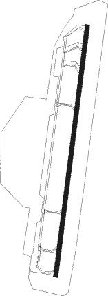
Foshan Shadi
Airport details
| Country | China |
| State | Guangdong Province |
| Region | |
| Airspace | Guangzhou Ctr |
| Municipality | Nanhai |
| Elevation | 16ft (5m) |
| Timezone | GMT +8 |
| Coordinates | 23.07123, 113.06853 |
| Magnetic var | |
| Type | land |
| Available since | X-Plane v10.40 |
| ICAO code | ZGFS |
| IATA code | n/a |
| FAA code | n/a |
Communication
Nearby beacons
| code | identifier | dist | bearing | frequency |
|---|---|---|---|---|
| POU | PINGZHOU VOR/DME | 7.3 | 112° | 114.10 |
| FO | GUANGZHOU NDB | 10.3 | 69° | 410 |
| CEN | CENCUN VOR/DME | 19.8 | 77° | 114.60 |
| GYA | GAOYAO VOR/DME | 32.1 | 270° | 116.50 |
| TAN | YUANTAN VOR/DME | 37.1 | 16° | 112.50 |
| CON | CONGHUA VOR/DME | 42.2 | 45° | 113 |
| NLG | NANLANG VOR/DME | 42.3 | 138° | 117.70 |
| SHL | SHILONG VOR/DME | 43.1 | 89° | 115.70 |
| ZUH | LIANSHENGWEI VOR/DME | 55.5 | 155° | 116.70 |
| GLN | GUANLAN VOR/DME | 57.6 | 111° | 112 |
| SHK | SHEKOU VOR/DME | 57.6 | 125° | 115.90 |
| ZAO | JIUZHOU VOR/DME | 58 | 147° | 117.20 |
| LKC | LUNG KWU CHAU VOR/DME | 61.3 | 130° | 113.20 |
| MCU | MACAO VOR/DME | 63.3 | 151° | 116.40 |
| SL | SHA LO WAN (HONG KONG) NDB | 65.9 | 133° | 268 |
| SMT | SIU MO TO VOR/DME | 67.1 | 129° | 114.80 |
| CH | CHAU DME | 73.8 | 132° | 112.30 |
| CC | HONG KONG CHEUNG NDB | 74.4 | 132° | 360 |
Disclaimer
The information on this website is not for real aviation. Use this data with the X-Plane flight simulator only! Data taken with kind consent from X-Plane 12 source code and data files. Content is subject to change without notice.
