Altai
Airport details
| Country | Mongolia |
| State | Govi-Altai |
| Region | ZM |
| Airspace | Ulaanbaatar Ctr |
| Municipality | Esonbulag |
| Elevation | 7233ft (2205m) |
| Timezone | GMT +8 |
| Coordinates | 46.37639, 96.21889 |
| Magnetic var | |
| Type | land |
| Available since | X-Plane v10.32 |
| ICAO code | ZMAT |
| IATA code | LTI |
| FAA code | n/a |
Communication
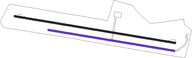
Runway info
Runway 10 / 28  | ||
| length | 2961m (9715ft) | |
| bearing | 100° / 280° | |
| width | 30m (98ft) | |
| surface | asphalt | |
| blast zone | 0m (0ft) / 62m (203ft) | |
| Runway 11 / 29 | ||
| length | 2319m (7608ft) | |
| bearing | 100° / 280° | |
| width | 30m (98ft) | |
| surface | gravel | |
Nearby beacons
| code | identifier | dist | bearing | frequency |
|---|---|---|---|---|
| VGA | TAISHIR VOR/DME | 0.1 | 303° | 116.40 |
Departure and arrival routes
| Transition altitude | 11483ft |
| Transition level | 15748ft |
| SID end points | distance | outbound heading | |
|---|---|---|---|
| RW10 | |||
| DONO1A | 81mi | 13° | |
| DULA1A | 80mi | 82° | |
| BH1A | 187mi | 93° | |
Instrument approach procedures
| runway | airway (heading) | route (dist, bearing) |
|---|---|---|
| RW28 | AT101 (261°) | AT101 11820ft AT102 (6mi, 200°) 9850ft |
| RNAV | AT102 9850ft AT103 (8mi, 280°) 8540ft ZMAT (5mi, 280°) 7219ft AT101 (14mi, 81°) 11820ft AT101 (turn) 11820ft |
Disclaimer
The information on this website is not for real aviation. Use this data with the X-Plane flight simulator only! Data taken with kind consent from X-Plane 12 source code and data files. Content is subject to change without notice.