Urt - Ovoot
Airport details
| Country | Mongolia |
| State | Ömnögovi |
| Region | ZM |
| Airspace | Ulaanbaatar Ctr |
| Municipality | Gurvantes |
| Elevation | 5126ft (1562m) |
| Timezone | GMT +8 |
| Coordinates | 43.01278, 101.33334 |
| Magnetic var | |
| Type | land |
| Available since | X-Plane v10.40 |
| ICAO code | ZMGT |
| IATA code | n/a |
| FAA code | n/a |
Communication
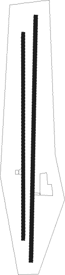
Runway info
Runway 01 / 19  | ||
| length | 2926m (9600ft) | |
| bearing | 8° / 188° | |
| width | 45m (148ft) | |
| surface | concrete | |
| Runway 01L / 19R | ||
| length | 2462m (8077ft) | |
| bearing | 6° / 186° | |
| width | 40m (131ft) | |
| surface | gravel | |
Disclaimer
The information on this website is not for real aviation. Use this data with the X-Plane flight simulator only! Data taken with kind consent from X-Plane 12 source code and data files. Content is subject to change without notice.