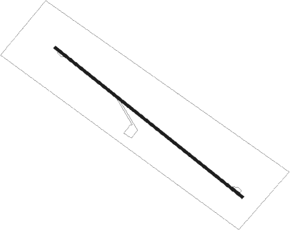
Ulaangom
Airport details
| Country | Mongolia |
| State | Uvs |
| Region | ZM |
| Airspace | Ulaanbaatar Ctr |
| Municipality | Ulaangom |
| Elevation | 3066ft (935m) |
| Timezone | GMT +7 |
| Coordinates | 50.06667, 91.93639 |
| Magnetic var | |
| Type | land |
| Available since | X-Plane v10.40 |
| ICAO code | ZMUG |
| IATA code | ULO |
| FAA code | n/a |
Communication
Nearby beacons
| code | identifier | dist | bearing | frequency |
|---|---|---|---|---|
| US | ULAANGOM NDB | 4.8 | 121° | 383 |
Departure and arrival routes
| Transition altitude | 7218ft |
| Transition level | 10800ft |
| SID end points | distance | outbound heading | |
|---|---|---|---|
| RW13 | |||
| TURU1B | 97mi | 99° | |
| UGOB1B | 59mi | 194° | |
| RW31 | |||
| TURU1A | 97mi | 99° | |
| UGOB1A | 59mi | 194° | |
| STAR starting points | distance | inbound heading | |
|---|---|---|---|
| RW31 | |||
| GOTBI1 | 37.8 | 10° | |
| LEBIR1 | 37.6 | 280° | |
Instrument approach procedures
| runway | airway (heading) | route (dist, bearing) |
|---|---|---|
| RW31 | TAVIM (340°) | TAVIM 11820ft UG002 (14mi, 33°) 6890ft |
| RW31 | TEKUR (284°) | TEKUR 11820ft UG002 (15mi, 270°) 6890ft |
| RW31 | UGUNA (280°) | UGUNA 7550ft UG002 (7mi, 235°) 6890ft |
| RNAV | UG002 6890ft UG001 (9mi, 301°) 4700ft ZMUG (6mi, 301°) 3015ft ZMUG (turn) 4270ft UGUNA (16mi, 100°) 7550ft UGUNA (turn) 7550ft |
Disclaimer
The information on this website is not for real aviation. Use this data with the X-Plane flight simulator only! Data taken with kind consent from X-Plane 12 source code and data files. Content is subject to change without notice.
