Nantong - Nantong Xingdong Intl'
Airport details
| Country | China |
| State | Jiangsu |
| Region | ZS |
| Airspace | Shanghai Ctr |
| Municipality | 如东县 |
| Elevation | 16ft (5m) |
| Timezone | GMT +8 |
| Coordinates | 32.06833, 120.98167 |
| Magnetic var | |
| Type | land |
| Available since | X-Plane v11.51r1 |
| ICAO code | ZSNT |
| IATA code | NTG |
| FAA code | n/a |
Communication
| Nantong Xingdong Intl' ATIS | 126.875 |
| Nantong Xingdong Intl' Nantong Tower | 118.200 |
Approach frequencies
| ILS-cat-I | RW36 | 109.1 | 18.00mi |
| ILS-cat-I | RW18 | 110.5 | 18.00mi |
| 3° GS | RW36 | 109.1 | 18.00mi |
| 3° GS | RW18 | 110.5 | 18.00mi |
Nearby Points of Interest:
Guangjiao Temple
-Former Residence of Zhao Yongxian
-Shuihui Garden
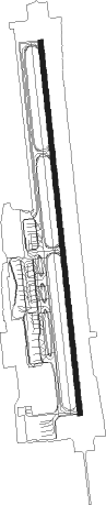
Runway info
| Runway 18 / 36 | ||
| length | 3403m (11165ft) | |
| bearing | 178° / 358° | |
| width | 45m (148ft) | |
| surface | concrete | |
| blast zone | 60m (197ft) / 60m (197ft) | |
Nearby beacons
| code | identifier | dist | bearing | frequency |
|---|---|---|---|---|
| W | XINGDONG (NANTONG) NDB | 1.1 | 183° | 425 |
| NTG | NANTONG VOR/DME | 1.8 | 356° | 115.60 |
| SUF | SHUOFANG VOR/DME | 44.2 | 224° | 114.10 |
| VMB | WUXI VOR/DME | 44.7 | 248° | 113.90 |
| PK | NANXIANG NDB | 50.3 | 156° | 208 |
| CGT | CHONGGU VOR/DME | 52.6 | 166° | 112.50 |
| SHA | HONGQIAO VOR/DME | 53.9 | 157° | 117.20 |
| JTN | JIUTING VOR/DME | 59.6 | 159° | 109.60 |
| HSH | HENGSHA VOR/DME | 60.9 | 129° | 114.40 |
| PDL | LIUZAO VOR/DME | 66.4 | 144° | 109.40 |
| PUD | PUDONG VOR/DME | 67.6 | 138° | 116.90 |
Departure and arrival routes
| Transition altitude | 9843ft |
| Transition level | 11811ft |
| SID end points | distance | outbound heading | |
|---|---|---|---|
| RW18 | |||
| POM12D, POM62X | 38mi | 168° | |
| UNT62X, UNT12D | 36mi | 281° | |
| RW36 | |||
| POM11D, POM61X | 38mi | 168° | |
| UNT11D, UNT61X | 36mi | 281° | |
| STAR starting points | distance | inbound heading | |
|---|---|---|---|
| RW18 | |||
| UNT02A, UNT52F, UNT54F | 36.3 | 101° | |
| POM02A, POM52F | 37.7 | 348° | |
| RW36 | |||
| UNT51F, UNT01A | 36.3 | 101° | |
| POM51F, POM01A | 37.7 | 348° | |
Holding patterns
| STAR name | hold at | type | turn | heading* | altitude | leg | speed limit |
|---|---|---|---|---|---|---|---|
| POM52F | NT307 | VHF | right | 184 (4)° | 1.0min timed | 205 | |
| UNT51F | NT307 | VHF | right | 184 (4)° | 1.0min timed | 205 | |
| UNT54F | NT307 | VHF | right | 184 (4)° | 1.0min timed | 205 | |
| *) magnetic outbound (inbound) holding course | |||||||
Disclaimer
The information on this website is not for real aviation. Use this data with the X-Plane flight simulator only! Data taken with kind consent from X-Plane 12 source code and data files. Content is subject to change without notice.