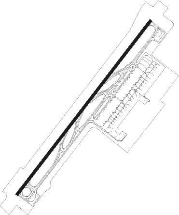
Yantai - Yantai Penglai Intl
Airport details
| Country | China |
| State | Shandong |
| Region | ZS |
| Airspace | Shanghai Ctr |
| Municipality | Yantai City |
| Elevation | 153ft (47m) |
| Timezone | GMT +8 |
| Coordinates | 37.66167, 120.97833 |
| Magnetic var | |
| Type | land |
| Available since | X-Plane v10.40 |
| ICAO code | ZSYT |
| IATA code | YNT |
| FAA code | n/a |
Communication
| Yantai Penglai Intl Yantai Ground | 121.600 |
| Yantai Penglai Intl Yantai ATIS | 126.450 |
| Yantai Penglai Intl Yantai Tower | 118.450 |
Approach frequencies
| ILS-cat-I | RW05 | 108.9 | 18.00mi |
| ILS-cat-I | RW23 | 108.5 | 18.00mi |
| 3° GS | RW05 | 108.9 | 18.00mi |
| 3° GS | RW23 | 108.5 | 18.00mi |
Nearby Points of Interest:
Penglai Pavilion
Nearby beacons
| code | identifier | dist | bearing | frequency |
|---|---|---|---|---|
| YCS | PENGLAI VOR/DME | 1.5 | 52° | 116.40 |
| FZ | TUNLI NDB | 15.8 | 136° | 247 |
| HCH | HUANGCHENG VOR/DME | 20.6 | 269° | 116.10 |
| FD | LAIYANG NDB | 46.9 | 205° | 298 |
Departure and arrival routes
| Transition altitude | 9843ft |
| Transition level | 11811ft |
| SID end points | distance | outbound heading | |
|---|---|---|---|
| RW05 | |||
| NIX61X, NIX11D | 35mi | 1° | |
| WEH11D, WEH61X | 66mi | 111° | |
| REP11D, REP61X | 62mi | 267° | |
| DOV11D, DOV61X | 74mi | 287° | |
| OSV61X, OSV11D | 46mi | 313° | |
| RW23 | |||
| NIX12D, NIX62X | 35mi | 1° | |
| WEH62X, WEH14D, WEH12D, WEH64X | 66mi | 111° | |
| REP62X, REP64X, REP12D, REP14D | 62mi | 267° | |
| DOV64X, DOV62X, DOV14D, DOV12D | 74mi | 287° | |
| OSV64X, OSV14D, OSV12D, OSV62X | 46mi | 313° | |
| STAR starting points | distance | inbound heading | |
|---|---|---|---|
| RW05 | |||
| REP01A, REP51F | 61.9 | 87° | |
| DOV01A, DOV51F | 73.6 | 107° | |
| OSV01A, OSV51F | 46.1 | 133° | |
| KAR01A, KAR51F | 37.4 | 156° | |
| WEH51F, WEH01A | 66.0 | 291° | |
| RW23 | |||
| REP52F, REP02A | 61.9 | 87° | |
| DOV02A, DOV52F | 73.6 | 107° | |
| OSV52F, OSV02A | 46.1 | 133° | |
| KAR52F, KAR02A | 37.4 | 156° | |
| WEH02A, WEH52F | 66.0 | 291° | |
Holding patterns
| STAR name | hold at | type | turn | heading* | altitude | leg | speed limit |
|---|---|---|---|---|---|---|---|
| DOV01A | PL215 | VHF | left | 334 (154)° | > 6890ft | 1.0min timed | 215 |
| DOV02A | A | NDB | left | 153 (333)° | > 3940ft | 1.0min timed | 215 |
| DOV51F | PL215 | VHF | left | 334 (154)° | > 6890ft | 1.0min timed | 215 |
| DOV52F | PL407 | VHF | right | 140 (320)° | 1.0min timed | ICAO rules | |
| KAR01A | PL215 | VHF | left | 334 (154)° | > 6890ft | 1.0min timed | 215 |
| KAR02A | A | NDB | left | 153 (333)° | > 3940ft | 1.0min timed | 215 |
| KAR51F | PL215 | VHF | left | 334 (154)° | > 6890ft | 1.0min timed | 215 |
| KAR52F | PL407 | VHF | right | 140 (320)° | 1.0min timed | ICAO rules | |
| OSV01A | PL215 | VHF | left | 334 (154)° | > 6890ft | 1.0min timed | 215 |
| OSV02A | A | NDB | left | 153 (333)° | > 3940ft | 1.0min timed | 215 |
| OSV51F | PL215 | VHF | left | 334 (154)° | > 6890ft | 1.0min timed | 215 |
| OSV52F | PL407 | VHF | right | 140 (320)° | 1.0min timed | ICAO rules | |
| REP01A | PL215 | VHF | left | 334 (154)° | > 6890ft | 1.0min timed | 215 |
| REP02A | A | NDB | left | 153 (333)° | > 3940ft | 1.0min timed | 215 |
| REP51F | PL215 | VHF | left | 334 (154)° | > 6890ft | 1.0min timed | 215 |
| REP52F | PL407 | VHF | right | 140 (320)° | 1.0min timed | ICAO rules | |
| WEH01A | PL206 | VHF | right | 154 (334)° | > 7880ft | 1.0min timed | 216 |
| WEH02A | YCS | NDB | right | 210 (30)° | > 5910ft | 1.0min timed | 216 |
| WEH51F | PL206 | VHF | right | 154 (334)° | > 7880ft | 1.0min timed | 216 |
| WEH52F | PL405 | VHF | left | 48 (228)° | 1.0min timed | 205 | |
| *) magnetic outbound (inbound) holding course | |||||||
Disclaimer
The information on this website is not for real aviation. Use this data with the X-Plane flight simulator only! Data taken with kind consent from X-Plane 12 source code and data files. Content is subject to change without notice.