Jekyll Island
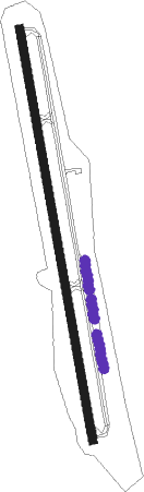
Airport details
| Country | United States of America |
| State | Georgia |
| Region | K7 |
| Airspace | Jacksonville Ctr |
| Municipality | Glynn County |
| Elevation | 11ft (3m) |
| Timezone | GMT -5 |
| Coordinates | 31.07447, -81.42778 |
| Magnetic var | |
| Type | land |
| Available since | X-Plane v10.40 |
| ICAO code | 09J |
| IATA code | n/a |
| FAA code | 09J |
Communication
| Jekyll Island CTAF/UNICOM | 123.050 |
Nearby Points of Interest:
Faith Chapel
-jekyll island club resort
-Rockefeller Cottage
-Horton House Historic Site
-Strachan House Garage
-St. Simons Island Light
-Frank M. Scarlett Federal Building
-Old Glynn County Courthouse
-Hofwyl-Broadfield Plantation
-Old Camden County Courthouse
-Woodbine Historic District
-West Darien Historic District
-The Ridge Historic District
-Sapelo Island Range Front Light
-St. Marys Historic District
-Sylvester Mumford House
-Orange Hall
-Fernandina Beach Historic District
-John Denham Palmer House
-Fairbanks House
-Bailey House
-Merrick-Simmons House
-Tabby House
-Fort Barrington
-Brantley County Courthouse
Nearby beacons
| code | identifier | dist | bearing | frequency |
|---|---|---|---|---|
| SSI | BRUNSWICK (ST SIMONS I) VORTAC | 1.7 | 217° | 109.80 |
| NRB | MAYPORT TACAN | 41.1 | 180° | 111.40 |
| JA | DINNS (JACKSONVILLE) NDB | 41.3 | 212° | 344 |
| CRG | CRAIG (JACKSONVILLE) VORTAC | 44.3 | 186° | 114.50 |
| MOQ | MC INTOSH (HINESVILLE) NDB | 45.6 | 354° | 263 |
| AY | WIKET (WAYCROSS) NDB | 52 | 285° | 219 |
| NIP | JACKSONVILLE TACAN | 52 | 196° | 108.20 |
| NZC | CECIL TACAN | 56.1 | 207° | 114.10 |
| SVN | HUNTER (SAVANNAH) VOR/DME | 58.1 | 17° | 111.60 |
| SV | WASSA (SAVANNAH) NDB | 60.2 | 25° | 335 |
| BHC | BAXLEY NDB | 62.4 | 304° | 376 |
Instrument approach procedures
| runway | airway (heading) | route (dist, bearing) |
|---|---|---|
| RW18 | BROUN (195°) | BROUN FIBRU (14mi, 212°) 2000ft |
| RNAV | FIBRU 2000ft WOXED (6mi, 174°) 1600ft 09J (5mi, 174°) 64ft (4965mi, 111°) 211ft AHJUN (4963mi, 291°) 2000ft AHJUN (turn) | |
| RW36 | CUBDU (46°) | CUBDU AHJUN (10mi, 90°) 2000ft AHJUN (turn) |
| RW36 | ECUFE (354°) | ECUFE AHJUN (5mi, 355°) 2000ft |
| RNAV | AHJUN 2000ft NUTWY (5mi, 354°) 1600ft RHOME (3mi, 354°) 720ft 09J (2mi, 354°) 64ft (4965mi, 111°) 500ft AHJUN (4963mi, 291°) 2000ft AHJUN (turn) |
Disclaimer
The information on this website is not for real aviation. Use this data with the X-Plane flight simulator only! Data taken with kind consent from X-Plane 12 source code and data files. Content is subject to change without notice.