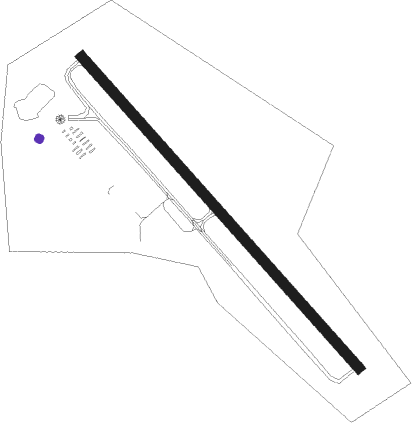
Montague - Turners Falls
Airport details
| Country | United States of America |
| State | Massachusetts |
| Region | K6 |
| Airspace | Boston Ctr |
| Municipality | Montague |
| Elevation | 357ft (109m) |
| Timezone | GMT -5 |
| Coordinates | 42.59161, -72.52300 |
| Magnetic var | |
| Type | land |
| Available since | X-Plane v10.40 |
| ICAO code | 0B5 |
| IATA code | n/a |
| FAA code | 0B5 |
Communication
| Turners Falls ASOS at ORE | 135.675 |
| Turners Falls CTAF/UNICOM | 123.000 |
| Turners Falls BOS APCH/Departure | 123.750 |
Nearby Points of Interest:
Turners Falls Historic District
-Weldon Hotel
-East Main-High Street Historic District
-United States Post Office–Greenfield Main
-Leavitt-Hovey House
-Garden Theater Block
-Montague Center Historic District
-Main Street Historic District (Greenfield, Massachusetts)
-Benson's New Block and the Mohawk Chambers
-Simeon Alexander, Jr., House
-Metacomet-Monadnock Trail
-Dedic Site
-Bernardston Congregational Unitarian Church
-Powers Institute Historic District
-Old Tavern Farm
-King Philip's Hill
-Moore's Corner Historic District
-Northfield Main Street Historic District
-Vernon District Schoolhouse No. 4
-Leverett Center Historic District
-Pine Street School
-Colrain Center Historic District
-Conway Center Historic District
-Pond Road Chapel
-East Leverett Historic District
Nearby beacons
| code | identifier | dist | bearing | frequency |
|---|---|---|---|---|
| EEN | DME | 15.8 | 49° | 109.40 |
| GDM | GARDNER VOR/DME | 20.7 | 96° | 110.60 |
| CEF | WESTOVER(SPRINGFIELD/CHIC TACAN | 23.6 | 180° | 114 |
| CTR | CHESTER VOR/DME | 26.1 | 235° | 115.10 |
| BAF | BARNES (WESTFIELD/SPRINGF VORTAC | 27.1 | 204° | 113 |
| CAM | CAMBRIDGE VOR/DME | 43.5 | 296° | 115 |
| MJ | FITZY (MANCHESTER) NDB | 46.8 | 75° | 209 |
| CNH | CLAREMONT NDB | 47.1 | 11° | 233 |
| PUT | PUTNAM VOR/DME | 48.6 | 133° | 117.40 |
| CON | CONCORD VOR/DME | 56.2 | 56° | 112.90 |
| HFD | HARTFORD VOR/DME | 57 | 181° | 114.90 |
| RUT | DME | 59.2 | 335° | 111 |
| LC | BLNAP (LACONIA) NDB | 71.3 | 46° | 328 |
Instrument approach procedures
| runway | airway (heading) | route (dist, bearing) |
|---|---|---|
| RWNVB | WUMOG (254°) | WUMOG YIDPU (6mi, 190°) 3500ft |
| RWNVB | YIDPU (276°) | YIDPU 6000ft YIDPU (turn) 3500ft |
| RWNVB | ZUKIL (298°) | ZUKIL YIDPU (6mi, 10°) 3500ft |
| RNAV | YIDPU 3500ft MARLY (6mi, 276°) 3100ft MAJAP (4mi, 276°) 1480ft (4638mi, 120°) 1480ft YIDPU (4628mi, 300°) 3500ft YIDPU (turn) |
Disclaimer
The information on this website is not for real aviation. Use this data with the X-Plane flight simulator only! Data taken with kind consent from X-Plane 12 source code and data files. Content is subject to change without notice.