Gasquet - Ward Field
Airport details
| Country | United States of America |
| State | California |
| Region | |
| Airspace | Seattle Ctr |
| Municipality | Del Norte County |
| Elevation | 354ft (108m) |
| Timezone | GMT -8 |
| Coordinates | 41.84495, -123.99006 |
| Magnetic var | |
| Type | land |
| Available since | X-Plane v10.40 |
| ICAO code | 0O9 |
| IATA code | n/a |
| FAA code | 0O9 |
Communication
Nearby Points of Interest:
Gasquet Ranger Station Historic District
-Mount Emily
-Osgood Ditch
-Radar Station B-71
-Illinois Valley Airport
-Cedar Guard Station
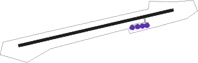
Runway info
| Runway 6 / 24 | ||
| length | 917m (3009ft) | |
| bearing | 84° / 264° | |
| width | 15m (50ft) | |
| surface | asphalt | |
| displ threshold | 147m (482ft) / 151m (495ft) | |
Nearby beacons
| code | identifier | dist | bearing | frequency |
|---|---|---|---|---|
| CEC | CRESCENT CITY VORTAC | 11.8 | 255° | 109 |
| ACV | ARCATA VOR/DME | 52.1 | 188° | 115.05 |
Disclaimer
The information on this website is not for real aviation. Use this data with the X-Plane flight simulator only! Data taken with kind consent from X-Plane 12 source code and data files. Content is subject to change without notice.