Pine Knot - Mc Creary Co
Airport details
| Country | United States of America |
| State | Kentucky |
| Region | K5 |
| Airspace | Indianapolis Ctr |
| Municipality | McCreary County |
| Elevation | 1370ft (418m) |
| Timezone | GMT -5 |
| Coordinates | 36.69370, -84.39475 |
| Magnetic var | |
| Type | land |
| Available since | X-Plane v10.40 |
| ICAO code | 18I |
| IATA code | n/a |
| FAA code | n/a |
Communication
| Mc Creary Co CTAF | 122.900 |
Nearby Points of Interest:
Stearns Administrative and Commercial District
-Lane Theater
-U.S. Post Office and Mine Rescue Station
-Burnside Methodist Church
-First Christian Church
-Carnegie Library
-Black Creek Fire Lookout Tower
-Pickett State Rustic Park Historic District
-Saint Camillus Academy
-Barton Chapel
-Fairchild House
-Kincaid-Howard House
-Old Wayne County High School
-A.E. Perkins House
-Somerset Downtown Commercial District
-Old Classroom Building, Union College
-Barbourville Commercial District
-Speed Hall
-Mitchell Building-First State Bank Building
-Soldiers and Sailors Memorial Gymnasium
-Battle of Dutton's Hill Monument
-First Evangelical Reformed Church
-Federal Building-Courthouse
-Poynter Building
-Kincaid House
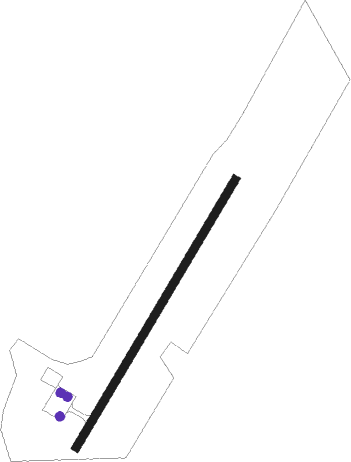
Runway info
| Runway 4 / 22 | ||
| length | 915m (3002ft) | |
| bearing | 41° / 221° | |
| width | 23m (75ft) | |
| surface | asphalt | |
| blast zone | 0m (0ft) / 15m (49ft) | |
Nearby beacons
| code | identifier | dist | bearing | frequency |
|---|---|---|---|---|
| SCX | SCOTT (ONEIDA) NDB | 17 | 219° | 403 |
| CDX | CUMBERLAND RIVER (SOMERSET) NDB | 22.7 | 317° | 388 |
| LOZ | LONDON VOR/DME | 24.5 | 40° | 116.55 |
| LVT | LIVINGSTON VOR/DME | 37.7 | 262° | 108.40 |
| VXV | VOLUNTEER (KNOXVILLE) VORTAC | 53.2 | 148° | 116.40 |
| DVK | GOODALL (DANVILLE) NDB | 55.8 | 337° | 311 |
| JXT | JEFFERSON (MORRISTOWN) NDB | 56.5 | 122° | 346 |
| HCH | HINCH MTN (CROSSVILLE) VOR/DME | 61.6 | 213° | 117.60 |
Instrument approach procedures
| runway | airway (heading) | route (dist, bearing) |
|---|---|---|
| RW04 | AGIGY (41°) | AGIGY 4700ft |
| RNAV | AGIGY 4700ft DELSY (6mi, 41°) 2800ft BEZIL (2mi, 41°) 2040ft 18I (2mi, 39°) 1410ft (5135mi, 113°) 1780ft CRORE (5129mi, 294°) 4000ft CRORE (turn) | |
| RW22 | CRORE (222°) | CRORE 4000ft |
| RNAV | CRORE 4000ft OARED (6mi, 221°) 3000ft ZUVOL (4mi, 221°) 1860ft 18I (2mi, 223°) 1382ft (5135mi, 113°) 1780ft AGIGY (5141mi, 293°) 4700ft AGIGY (turn) |
Disclaimer
The information on this website is not for real aviation. Use this data with the X-Plane flight simulator only! Data taken with kind consent from X-Plane 12 source code and data files. Content is subject to change without notice.