Middlesboro - Middlesboro-bell County
Airport details
| Country | United States of America |
| State | Kentucky |
| Region | K5 |
| Airspace | Indianapolis Ctr |
| Municipality | Middlesborough |
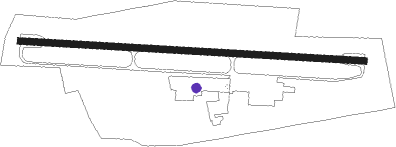
| Elevation | 1150ft (351m) |
| Timezone | GMT -5 |
| Coordinates | 36.61025, -83.73730 |
| Magnetic var | |
| Type | land |
| Available since | X-Plane v10.40 |
| ICAO code | 1A6 |
| IATA code | n/a |
| FAA code | n/a |
Communication
| MiddlesBoro-Bell County AWOS 3 | 119.425 |
| MiddlesBoro-Bell County CTAF/UNICOM | 122.800 |
| MiddlesBoro-Bell County 1A6 ATC Tower Frequency | 128.800 |
Nearby Points of Interest:
American Association, Limited, Office Building
-Middlesboro Downtown Commercial District
-Kincaid-Ausmus House
-Pineville Courthouse Square Historic District
-Kincaid House
-Hensley Settlement
-Graham-Kivett House
-Claiborne County Jail
-Old Classroom Building, Union College
-Barbourville Commercial District
-Mitchell Building-First State Bank Building
-Soldiers and Sailors Memorial Gymnasium
-Speed Hall
-U.S. Post Office and Mine Rescue Station
-Kincaid-Howard House
-Hamilton-Lay Store
-Lane Theater
-Henderson Chapel African Methodist Episcopal Zion Church
-William Cocke House
-Harlan Commercial District
-Lea Springs
-Poplar Hill
-Saint Camillus Academy
-Vardy Community School
-First Christian Church
Nearby beacons
| code | identifier | dist | bearing | frequency |
|---|---|---|---|---|
| LOZ | LONDON VOR/DME | 31 | 319° | 116.55 |
| JXT | JEFFERSON (MORRISTOWN) NDB | 32.5 | 152° | 346 |
| SCX | SCOTT (ONEIDA) NDB | 42 | 260° | 403 |
| RVN | ROGERSVILLE NDB | 42.1 | 100° | 329 |
| VXV | VOLUNTEER (KNOXVILLE) VORTAC | 43 | 193° | 116.40 |
| CDX | CUMBERLAND RIVER (SOMERSET) NDB | 50.9 | 292° | 388 |
| AZQ | DME | 52.1 | 31° | 111.20 |
| SOT | SNOWBIRD VORTAC | 59.3 | 140° | 108.80 |
Instrument approach procedures
| runway | airway (heading) | route (dist, bearing) |
|---|---|---|
| RWNVA | WIDMO (225°) | WIDMO 5400ft |
| RNAV | WIDMO 5400ft TOCUV (3mi, 225°) 4400ft ZIZTA (3mi, 225°) 3600ft UPODE (6mi, 225°) 3080ft (5103mi, 114°) 3080ft JULEI (5088mi, 294°) 5200ft JULEI (turn) |
Disclaimer
The information on this website is not for real aviation. Use this data with the X-Plane flight simulator only! Data taken with kind consent from X-Plane 12 source code and data files. Content is subject to change without notice.