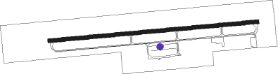
Prattville - Prattville Grouby Fld
Airport details
| Country | United States of America |
| State | Alabama |
| Region | K7 |
| Airspace | Atlanta Ctr |
| Municipality | Prattville |
| Elevation | 225ft (69m) |
| Timezone | GMT -6 |
| Coordinates | 32.43872, -86.51270 |
| Magnetic var | |
| Type | land |
| Available since | X-Plane v10.40 |
| ICAO code | 1A9 |
| IATA code | n/a |
| FAA code | n/a |
Communication
| Prattville Grouby Fld CTAF/UNICOM | 122.800 |
| Prattville Grouby Fld MONTGOMERY Approach/Departure | 121.200 |
Nearby Points of Interest:
Montgomery-Janes-Whittaker House
-Mount Sinai School
-Stone Plantation
-Simler Hall
-Building 800-Austin Hall
-Maxwell Air Force Base Senior Officers' Quarters Historic District
-Lowndesboro Historic District
-Cottage Hill Historic District
-Union Station
-St. Jude Educational Institute
-Winter Place
-McBryde-Screws-Tyson House
-Lower Commerce Street Historic District
-Meadowlawn Plantation
-Cleveland Court Apartments 620–638
-Bell Building
-Frank M. Johnson, Jr., Federal Building and United States Courthouse
-Court Square Historic District
-St. John's Episcopal Church
-Sayre Street School
-William Lowndes Yancey Law Office
-Pepperman House
-Patrick Henry Brittan House
-Dowe Historic District
-Gov. Thomas G. Jones House
Nearby beacons
| code | identifier | dist | bearing | frequency |
|---|---|---|---|---|
| MG | MARRA (MONTGOMERY) NDB | 7.6 | 179° | 245 |
| MXF | MAXWELL (MONTGOMERY) TACAN | 8.1 | 112° | 115 |
| MGM | MONTGOMERY VORTAC | 16.2 | 138° | 112.10 |
| SE | POLLK (SELMA) NDB | 23.3 | 248° | 344 |
| TOI | BLOOD (TROY) NDB | 41.9 | 146° | 365 |
| TGE | TUSKEGEE VOR/DME | 42.8 | 87° | 117.30 |
| OKW | BROOKWOOD VORTAC | 60.7 | 317° | 111 |
| MVC | MONROEVILLE VORTAC | 72.7 | 221° | 116.80 |
Instrument approach procedures
| runway | airway (heading) | route (dist, bearing) |
|---|---|---|
| RW09 | ANWAF (89°) | ANWAF 3100ft |
| RNAV | ANWAF 3100ft EKUSY (7mi, 89°) 1900ft 1A9 (6mi, 89°) 265ft (5228mi, 111°) 625ft ANWAF (5241mi, 290°) 3100ft ANWAF (turn) | |
| RW27 | ZOREL (269°) | ZOREL 3000ft |
| RNAV | ZOREL 3000ft JEMER (10mi, 269°) 2300ft 1A9 (7mi, 269°) 243ft (5228mi, 111°) 496ft ANWAF (5241mi, 290°) 3100ft ANWAF (turn) |
Disclaimer
The information on this website is not for real aviation. Use this data with the X-Plane flight simulator only! Data taken with kind consent from X-Plane 12 source code and data files. Content is subject to change without notice.