Hudson - Columbia County
Airport details
| Country | United States of America |
| State | New York |
| Region | K6 |
| Airspace | Boston Ctr |
| Municipality | Columbia County |
| Elevation | 198ft (60m) |
| Timezone | GMT -5 |
| Coordinates | 42.29131, -73.71033 |
| Magnetic var | |
| Type | land |
| Available since | X-Plane v10.40 |
| ICAO code | 1B1 |
| IATA code | n/a |
| FAA code | n/a |
Communication
| Columbia County AWOS 3 | 133.525 |
| Columbia County CTAF/UNICOM | 123.050 |
| Columbia County AI Tower | 128.800 |
| Columbia County ALBANY Approach/Departure | 132.825 |
Nearby Points of Interest:
Church of St. John the Evangelist
-Jan Van Hoesen House
-Mellenville Railroad Station
-Turtle House
-Elisha Williams House
-Columbia Turnpike-West Tollhouse
-Stephen Storm House
-George Felpel House
-Brick Row Historic District
-Dr. Abram Jordan House
-Van Rensselaer Lower Manor House
-Stephen Miller House
-Rossman-Prospect Avenue Historic District
-Houses at 37–47 North Fifth Street
-Harriet Phillips Bungalow
-Cornelius H. Evans House
-Hudson Historic District
-Claverack Free Library
-United States Post Office
-William Henry Ludlow House
-First Columbia County Courthouse
-Cornelius S. Muller House
-Stephen Hogeboom House
-Henry A. and Evanlina Dubois House
-Stranahan-DelVecchio House
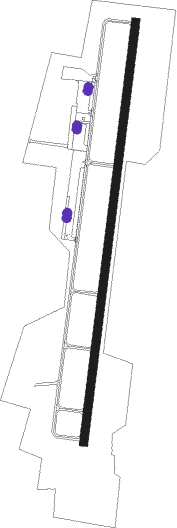
Runway info
| Runway 3 / 21 | ||
| length | 1632m (5354ft) | |
| bearing | 15° / 195° | |
| width | 30m (100ft) | |
| surface | asphalt | |
| displ threshold | 0m (0ft) / 49m (161ft) | |
Nearby beacons
| code | identifier | dist | bearing | frequency |
|---|---|---|---|---|
| PFH | PHILMONT (HUDSON) NDB | 2.3 | 199° | 272 |
| ALB | ALBANY VORTAC | 27.6 | 348° | 115.30 |
| PWL | PAWLING (POUGHKEEPSIE) VOR/DME | 31.7 | 168° | 114.30 |
| AL | HAWKY (ALBANY) NDB | 31.8 | 349° | 219 |
| CTR | CHESTER VOR/DME | 33.8 | 90° | 115.10 |
| HEU | HUNTER (SCHENECTADY) NDB | 35.2 | 338° | 356 |
| IGN | KINGSTON VOR/DME | 37.9 | 190° | 117.60 |
| BAF | BARNES (WESTFIELD/SPRINGF VORTAC | 44.8 | 97° | 113 |
| CAM | CAMBRIDGE VOR/DME | 45.2 | 28° | 115 |
| SKU | STANWYCK (NEWBURGH) NDB | 48.2 | 204° | 261 |
| JJH | JOHNSTOWN NDB | 50.6 | 319° | 523 |
| SW | NEELY (NEWBURGH) NDB | 53.6 | 213° | 335 |
| GF | GANSE (GLENS FALLS) NDB | 58 | 6° | 209 |
| HUO | HUGUENOT VOR/DME | 66 | 225° | 116.10 |
Instrument approach procedures
| runway | airway (heading) | route (dist, bearing) |
|---|---|---|
| RW03 | ANOPE (44°) | ANOPE 4600ft KROWL (5mi, 99°) 3200ft HAROY (4mi, 15°) 2200ft |
| RW03 | KROWL (15°) | KROWL 3200ft HAROY (4mi, 15°) 2200ft |
| RW03 | PUCBY (343°) | PUCBY 4900ft KROWL (5mi, 279°) 3200ft HAROY (4mi, 15°) 2200ft |
| RNAV | HAROY 2200ft COPAP (2mi, 15°) 1700ft 1B1 (5mi, 15°) 238ft JAPUT (11mi, 16°) 3200ft JAPUT (turn) | |
| RW21 | JAPUT (196°) | JAPUT 3200ft |
| RW21 | PYXES (223°) | PYXES JAPUT (6mi, 264°) 3200ft |
| RW21 | ZIBRO (164°) | ZIBRO JAPUT (6mi, 114°) 3200ft |
| RNAV | JAPUT 3200ft QEZAZ (6mi, 196°) 2000ft HARDA (3mi, 195°) 1060ft 1B1 (3mi, 195°) 254ft (4686mi, 120°) 562ft KROWL (4686mi, 300°) 3200ft KROWL (turn) 3200ft |
Disclaimer
The information on this website is not for real aviation. Use this data with the X-Plane flight simulator only! Data taken with kind consent from X-Plane 12 source code and data files. Content is subject to change without notice.