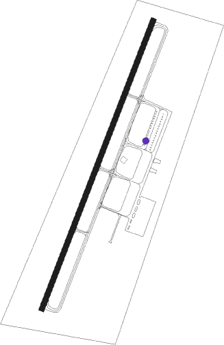
Georgetown - Georgetown Regnl
Airport details
| Country | United States of America |
| State | Kentucky |
| Region | K5 |
| Airspace | Indianapolis Ctr |
| Municipality | Scott County |
| Elevation | 945ft (288m) |
| Timezone | GMT -5 |
| Coordinates | 38.23444, -84.43469 |
| Magnetic var | |
| Type | land |
| Available since | X-Plane v10.40 |
| ICAO code | 27K |
| IATA code | n/a |
| FAA code | 27K |
Communication
| Georgetown Regnl CTAF/UNICOM | 123.000 |
| Georgetown Regnl AWOS-3 | 119.975 |
| Georgetown Regnl LEXINGTON Approach/Departure | 120.750 |
| Georgetown Regnl LEXINGTON Approach/Departure | 120.150 |
Nearby Points of Interest:
Georgetown East Main Street Residential District
-Shropshire House
-Giddings Hall, Georgetown College
-Georgetown College Historic Buildings
-Hawkins House
-Johnston-Jacobs House
-First African Baptist Church and Parsonage
-Garth School
-Branham House
-Holy Trinity Episcopal Church
-Scott County Jail Complex
-Payne-Desha House
-South Broadway Neighborhood District
-Cardome Centre
-Hurricane Hall
-Paris Courthouse Square Historic District
-Cynthiana Commercial District
-Central Kentucky Blue Grass Seed Co.
-Lexington National Cemetery
-Spur Gasoline Station
-The Grange
-Church of the Advent, Episcopal
-Liggett and Myers Harpring Tobacco Storage Warehouse
-Opera House and Yates Bookshop Building
-Episcopal Burying Ground and Chapel
Nearby beacons
| code | identifier | dist | bearing | frequency |
|---|---|---|---|---|
| GN | BRIDL (LEXINGTON) NDB | 7.4 | 213° | 340 |
| HYK | LEXINGTON VOR/DME | 16.1 | 188° | 112.60 |
| LE | BLAYD (LEXINGTON) NDB | 18.2 | 222° | 242 |
| FFT | FRANKFORT VOR | 22.5 | 264° | 109.40 |
| IOB | MOUNT STERLING NDB | 23.8 | 111° | 210 |
| FLM | FALMOUTH VOR/DME | 25.5 | 17° | 117 |
| DVK | GOODALL (DANVILLE) NDB | 42.4 | 207° | 311 |
| CVG | CINCINNATI VORTAC | 48.6 | 341° | 117.30 |
| PWF | SPORTYS (BATAVIA) NDB | 51.6 | 15° | 245 |
Instrument approach procedures
| runway | airway (heading) | route (dist, bearing) |
|---|---|---|
| RW03 | EPORE (3°) | EPORE 3000ft ZENWA (5mi, 291°) 3000ft |
| RW03 | UPDEW (55°) | UPDEW 3000ft ZENWA (5mi, 111°) 3000ft |
| RW03 | ZENWA (31°) | ZENWA 3000ft |
| RNAV | ZENWA 3000ft OKNEW (6mi, 31°) 2600ft FEMSA (3mi, 31°) 1600ft 27K (2mi, 31°) 965ft ETOXY (5mi, 31°) GENUS (8mi, 276°) 3000ft GENUS (turn) | |
| RW21-Y | EPZOK (182°) | EPZOK 3000ft OBUGE (5mi, 111°) 3000ft |
| RW21-Y | OBUGE (211°) | OBUGE 3000ft |
| RW21-Y | URAYE (236°) | URAYE 3000ft OBUGE (5mi, 291°) 3000ft |
| RNAV | OBUGE 3000ft ETOXY (6mi, 211°) 2500ft CUDIG (3mi, 211°) 1580ft 27K (2mi, 211°) 977ft (5143mi, 114°) 1350ft GENUS (5149mi, 294°) 3000ft GENUS (turn) | |
| RW21-Z | EPZOK (182°) | EPZOK 3000ft OBUGE (5mi, 111°) 3000ft |
| RW21-Z | OBUGE (211°) | OBUGE 3000ft |
| RW21-Z | URAYE (236°) | URAYE 3000ft OBUGE (5mi, 291°) 3000ft |
| RNAV | OBUGE 3000ft ETOXY (6mi, 211°) 2500ft CUDIG (3mi, 211°) 1580ft 27K (2mi, 211°) 977ft YAPUT (4mi, 211°) SOKOC (10mi, 293°) GENUS (7mi, 53°) 3000ft GENUS (turn) |
Disclaimer
The information on this website is not for real aviation. Use this data with the X-Plane flight simulator only! Data taken with kind consent from X-Plane 12 source code and data files. Content is subject to change without notice.
