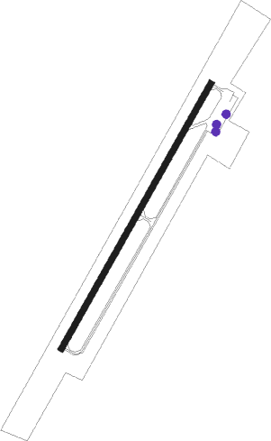
Warren - Warren Municipal
Airport details
| Country | United States of America |
| State | Arkansas |
| Region | K4 |
| Airspace | Memphis Ctr |
| Municipality | Bradley County |
| Elevation | 233ft (71m) |
| Timezone | GMT -6 |
| Coordinates | 33.56044, -92.08539 |
| Magnetic var | |
| Type | land |
| Available since | X-Plane v10.40 |
| ICAO code | 3M9 |
| IATA code | n/a |
| FAA code | 3M9 |
Communication
| Warren Municipal CTAF | 122.900 |
| Warren Municipal MEMPHIS ApproachROACH | 135.875 |
| Warren Municipal MEMPHIS DepartureARTURE | 135.875 |
Nearby Points of Interest:
Adams-Leslie House
-Ederington House
-Warren Post Office
-Warren Commercial Historic District
-Blankinship Motor Company Building
-Warren and Ouachita Valley Railway Station
-Warren Brick Streets
-Bradley County Courthouse and Clerk's Office
-St. Luke's Catholic Church
-Dr. John Wilson Martin House
-Bailey House
-Davis-Adams House
-Wilson-Martin House
-New Zion AME Zion Church
-Hermitage City Hall and Jail
-Mt. Olive Rosenwald School
-Champ Grubbs House
-Attwood-Hopson House
-Barnett-Attwood House
-Garvin Cavaness House
-Rough and Ready Cemetery
-Hotchkiss House
-Drew County Courthouse
-Monticello Post Office
-Hampton Masonic Lodge Building
Runway info
| Runway 3 / 21 | ||
| length | 1169m (3835ft) | |
| bearing | 39° / 219° | |
| width | 23m (75ft) | |
| surface | asphalt | |
Nearby beacons
| code | identifier | dist | bearing | frequency |
|---|---|---|---|---|
| MON | MONTICELLO VOR/DME | 18.5 | 90° | 111.60 |
| EL | LADOS (EL DORADO) NDB | 36.1 | 247° | 418 |
| ELD | EL DORADO VOR/DME | 37.7 | 245° | 115.50 |
| PBF | PINE BLUFF VOR/DME | 41.9 | 13° | 116 |
| FWV | TRUXNO (FARMERVILLE) NDB | 47.3 | 200° | 379 |
| BQP | BASTROP NDB | 49.4 | 166° | 329 |
| TT | STUTT (STUTTGART) NDB | 62 | 28° | 338 |
| ROQ | RUSTON NDB | 62.5 | 208° | 368 |
Instrument approach procedures
| runway | airway (heading) | route (dist, bearing) |
|---|---|---|
| RW03 | JUSGA (112°) | JUSGA WUBOB (15mi, 157°) 3000ft ULERE (5mi, 119°) 2500ft |
| RW03 | WAXOK (13°) | WAXOK ULERE (5mi, 300°) 2500ft |
| RNAV | ULERE 2500ft OHNIF (6mi, 39°) 1800ft YABUS (3mi, 39°) 920ft 3M9 (3mi, 39°) 242ft (5510mi, 110°) 635ft WESOS (5506mi, 290°) JUSGA (19mi, 274°) 3000ft JUSGA (turn) | |
| RW21 | JUSGA (112°) | JUSGA ZAKID (18mi, 77°) 3000ft YUBUT (5mi, 120°) 2500ft |
| RW21 | ZATKO (242°) | ZATKO YUBUT (5mi, 300°) 2500ft |
| RNAV | YUBUT 2500ft BIMTY (6mi, 219°) 1800ft 3M9 (5mi, 219°) 280ft (5510mi, 110°) 635ft ZANOP (5512mi, 290°) JUSGA (17mi, 306°) 3000ft JUSGA (turn) |
Disclaimer
The information on this website is not for real aviation. Use this data with the X-Plane flight simulator only! Data taken with kind consent from X-Plane 12 source code and data files. Content is subject to change without notice.
