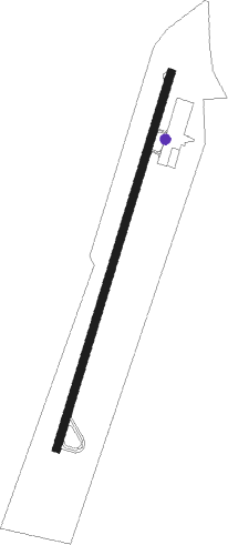
Star - Montgomery Co
Airport details
| Country | United States of America |
| State | North Carolina |
| Region | K7 |
| Airspace | Washington Ctr |
| Municipality | Montgomery County |
| Elevation | 626ft (191m) |
| Timezone | GMT -5 |
| Coordinates | 35.38466, -79.79026 |
| Magnetic var | |
| Type | land |
| Available since | X-Plane v10.40 |
| ICAO code | 43A |
| IATA code | n/a |
| FAA code | n/a |
Communication
| MONTGOMERY CO AWOS | 119.275 |
| MONTGOMERY CO CTAF/UNICOM | 122.800 |
| MONTGOMERY CO Tower | 128.100 |
| MONTGOMERY CO Approach | 127.800 |
| MONTGOMERY CO Departure | 127.800 |
Nearby Points of Interest:
Montgomery County Courthouse
-Jugtown Pottery
-Narrows Dam and Power Plant Complex
-Bostick School
-Lewis-Thornburg Farm
-Alexander Kelly House
-Randle House
-Coleridge Historic District
-Carthage Historic District
-Moore County Courthouse
-J.C. Black House
-Lloyd-Howe House
-Randolph County Courthouse
-Mystic Cottage
-Pee Dee Avenue Historic District
-Five Points Historic District
-Isaiah Wilson Snugs House
-Thomas Marcellus Denning House
-Second Street Historic District
-Albemarle Opera House
-Downtown Albemarle Historic District
-Alfred Dockery House
-Franklinville Historic District
-Aberdeen Historic District
-Southern Pines Historic District
Nearby beacons
| code | identifier | dist | bearing | frequency |
|---|---|---|---|---|
| SDZ | SANDHILLS (SOUTHERN PINES VORTAC | 14.1 | 130° | 111.80 |
| VU | ALLER (ALBEMARLE) NDB | 15.6 | 290° | 346 |
| LIB | LIBERTY VORTAC | 27 | 23° | 113 |
| HB | ALAMM NDB | 37 | 19° | 361 |
| POB | POPE (FAYETTEVILLE) TACAN | 39.9 | 106° | 113.80 |
| RU | ROVDY (SALISBURY) NDB | 40 | 296° | 275 |
| GSO | GREENSBORO VORTAC | 40.7 | 344° | 116.20 |
| POB | POPE (FAYETTEVILLE) NDB | 42 | 101° | 338 |
| ME | MAXTN (MAXTON) NDB | 42.6 | 152° | 257 |
| IN | REENO (WINSTON SALEM) NDB | 45.1 | 331° | 317 |
| BES | BENNETTSVILLE NDB | 45.9 | 176° | 230 |
| CTF | CHESTERFIELD VOR/DME | 50.1 | 213° | 108.20 |
| FGP | FORT BRAGG NDB | 50.1 | 104° | 393 |
| FAY | FAYETTEVILLE VOR/DME | 50.9 | 114° | 108.80 |
| UDG | DARLINGTON NDB | 56.7 | 186° | 245 |
| JB | JIGEL (LUMBERTON) NDB | 59.7 | 142° | 384 |
| DLC | DILLON NDB | 59.8 | 156° | 274 |
| SIF | SLAMMER (REIDSVILLE) NDB | 59.8 | 2° | 423 |
| HVS | HARTSVILLE NDB | 60.9 | 199° | 341 |
| HUR | PERSON (ROXBORO) NDB | 61.9 | 40° | 220 |
Instrument approach procedures
| runway | airway (heading) | route (dist, bearing) |
|---|---|---|
| RW03 | GIPPR (48°) | GIPPR PEKNN (6mi, 89°) 3000ft |
| RW03 | RELPY (0°) | RELPY PEKNN (4mi, 269°) 3000ft PEKNN (turn) 3000ft |
| RNAV | PEKNN 3000ft ZIVOS (7mi, 25°) 2200ft ZEDOM (2mi, 26°) 1360ft 43A (2mi, 26°) 618ft (4906mi, 114°) 1032ft JEGUD (4903mi, 294°) 3000ft JEGUD (turn) | |
| RW21 | GANTS (102°) | GANTS JEGUD (20mi, 75°) 3000ft JEGUD (turn) 3000ft |
| RW21 | LIB (203°) | LIB JEGUD (16mi, 200°) 3000ft |
| RNAV | JEGUD 3000ft ZOGMI (6mi, 206°) 2300ft WAVMA (3mi, 206°) 1280ft 43A (2mi, 206°) 666ft (4906mi, 114°) 1032ft ZIVOS (4907mi, 294°) PEKNN (7mi, 205°) 3000ft PEKNN (turn) |
Disclaimer
The information on this website is not for real aviation. Use this data with the X-Plane flight simulator only! Data taken with kind consent from X-Plane 12 source code and data files. Content is subject to change without notice.
