Central Jersey Rgnl
Airport details
| Country | United States of America |
| State | New Jersey |
| Region | K6 |
| Airspace | New York Ctr |
| Municipality | Hillsborough Township |
| Elevation | 83ft (25m) |
| Timezone | GMT -5 |
| Coordinates | 40.52444, -74.59829 |
| Magnetic var | |
| Type | land |
| Available since | X-Plane v10.40 |
| ICAO code | 47N |
| IATA code | n/a |
| FAA code | n/a |
Communication
| CENTRAL JERSEY RGNL CTAF/UNICOM | 122.700 |
| CENTRAL JERSEY RGNL NEW YORK Approach/Departure | 132.800 |
Nearby Points of Interest:
Franklin Inn
-Millstone Historic District
-Van Veghten House
-West End Hose Company Number 3
-Somerset County Court House complex
-Millstone Valley Agricultural District
-William L. Hutcheson Memorial Forest
-Old Dutch Parsonage
-Wallace House
-Daniel Robert House
-General John Frelinghuysen House
-Van Horne House
-Relief Home Company No. 2 Engine House
-D&R Canal Trail
-Middlebush Village Historic District
-Brook Arts Center
-Staats House
-Old Stone Arch Bridge
-Six Mile Run
-Joseph and Minnie White House
-Van Wickle House
-Isaac Onderdonk House
-South Branch Schoolhouse
-Road Up Raritan Historic District
-Matthias Smock House
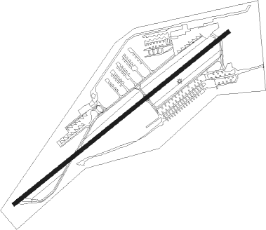
Runway info
| Runway 7 / 25 | ||
| length | 1071m (3514ft) | |
| bearing | 63° / 243° | |
| width | 15m (50ft) | |
| surface | asphalt | |
| displ threshold | 189m (620ft) / 76m (249ft) | |
| blast zone | 0m (0ft) / 64m (210ft) | |
Nearby beacons
| code | identifier | dist | bearing | frequency |
|---|---|---|---|---|
| SBJ | SOLBERG VOR/DME | 7.4 | 292° | 112.90 |
| CAT | CHATHAM NDB | 15 | 38° | 254 |
| BWZ | BROADWAY (SCHOOLEY'S MT) VOR/DME | 19.3 | 321° | 114.20 |
| RBV | ROBBINSVILLE VORTAC | 19.9 | 162° | 113.80 |
| ARD | YARDLEY VOR/DME | 21.5 | 229° | 108.20 |
| COL | COLTS NECK VOR/DME | 23.7 | 116° | 115.40 |
| MM | MOREE (MORRISTOWN) NDB | 24.4 | 37° | 392 |
| TE | TORBY (TETERBORO) NDB | 27 | 59° | 214 |
| STW | STILLWATER VOR/DME | 30.8 | 330° | 109.60 |
| GXU | MC GUIRE (WRIGHTSTOWN) VORTAC | 30.9 | 180° | 110.60 |
| NEL | LAKEHURST NDB | 31.2 | 151° | 396 |
| TEB | TETERBORO VOR/DME | 31.2 | 59° | 108.40 |
| NEL | LAKEHURST TACAN | 31.3 | 153° | 111.80 |
| CRI | CANARSIE VOR/DME | 32.5 | 83° | 112.30 |
| SAX | SPARTA VORTAC | 32.7 | 6° | 115.70 |
| LGA | LA GUARDIA (NEW YORK) VOR/DME | 36.7 | 70° | 113.10 |
| JFK | KENNEDY (NEW YORK) VOR/DME | 38.2 | 83° | 115.90 |
| ING | AMBLER NDB | 39.5 | 240° | 275 |
| FJC | ALLENTOWN VORTAC | 40.8 | 283° | 117.50 |
| CYN | COYLE VORTAC | 43.1 | 167° | 113.40 |
| PTW | POTTSTOWN VORTAC | 47.6 | 253° | 116.50 |
| HUO | HUGUENOT VOR/DME | 53.1 | 0° | 116.10 |
| SW | NEELY (NEWBURGH) NDB | 60.1 | 21° | 335 |
| VCN | CEDAR LAKE (MILLVILLE) VOR/DME | 61.6 | 200° | 115.20 |
| OOD | WOODSTOWN VORTAC | 62.4 | 218° | 112.80 |
Departure and arrival routes
| Transition altitude | 18000ft |
| Transition level | 18000ft |
| SID end points | distance | outbound heading | |
|---|---|---|---|
| RW07 | |||
| CENTR1 | 22mi | 229° | |
| RW25 | |||
| CENTR1 | 22mi | 229° | |
| STAR starting points | distance | inbound heading | |
|---|---|---|---|
| ALL | |||
| JAIKE3 | 64.0 | 54° | |
| MAZIE3 | 26.3 | 68° | |
Instrument approach procedures
| runway | airway (heading) | route (dist, bearing) |
|---|---|---|
| RW07 | ADIUM (63°) | ADIUM 2000ft |
| RW07 | BIGGY (74°) | BIGGY ADIUM (8mi, 89°) 2000ft |
| RNAV | ADIUM 2000ft BOXZE (6mi, 63°) 1700ft ZIPTU (3mi, 63°) 740ft 47N (2mi, 63°) 112ft (4706mi, 119°) 486ft ADIUM (4713mi, 298°) 2000ft ADIUM (turn) | |
| RW25 | SBJ (112°) | SBJ JOKMI (13mi, 32°) 2500ft ATUCA (9mi, 102°) 2500ft YODUR (7mi, 162°) 2000ft |
| RNAV | YODUR 2000ft ZOMIM (7mi, 243°) 1700ft DUYAB (3mi, 243°) 620ft 47N (2mi, 243°) 107ft (4706mi, 119°) 600ft METRO (4708mi, 298°) 2000ft METRO (turn) |
Holding patterns
| STAR name | hold at | type | turn | heading* | altitude | leg | speed limit |
|---|---|---|---|---|---|---|---|
| JAIKE3 | MAZIE | VHF | left | 237 (57)° | < 17999ft | 1.0min timed | 210 |
| JAIKE3 | PALEO | VHF | left | 232 (52)° | < 45000ft | 1.5min timed | ICAO rules |
| JAIKE3 | SPNCR | VHF | right | 227 (47)° | 6001ft - 14000ft | DME 4.0mi | 210 |
| MAZIE3 | BACKY | VHF | right | 216 (36)° | DME 7.0mi | ICAO rules | |
| MAZIE3 | MAZIE | VHF | left | 237 (57)° | < 17999ft | 1.0min timed | 210 |
| MAZIE3 | RAZER | VHF | right | 229 (49)° | < 60000ft | DME 6.0mi | 210 |
| *) magnetic outbound (inbound) holding course | |||||||
Disclaimer
The information on this website is not for real aviation. Use this data with the X-Plane flight simulator only! Data taken with kind consent from X-Plane 12 source code and data files. Content is subject to change without notice.