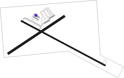
Sturgis - Sturgis Muni
Airport details
| Country | United States of America |
| State | South Dakota |
| Region | K3 |
| Airspace | Denver Ctr |
| Municipality | Meade County |
| Elevation | 3243ft (988m) |
| Timezone | GMT -7 |
| Coordinates | 44.41868, -103.37772 |
| Magnetic var | |
| Type | land |
| Available since | X-Plane v10.40 |
| ICAO code | 49B |
| IATA code | n/a |
| FAA code | n/a |
Communication
| Sturgis Muni AWOS | 122.800 |
| Sturgis Muni CTAF/UNICOM | 122.800 |
| Sturgis Muni ELLSWORTH Approach/Departure | 119.500 |
Nearby Points of Interest:
Bear Butte
-Williams Middle School
-Frawley Ranch
-Tomahawk Lake Country Club
-Mount Theodore Roosevelt Monument
-St. Lawrence O'Toole Catholic Church
-Old Finnish Lutheran Church
-Webb S. Knight House
-James A. Corbin House
-Pap Madison Cabin
-Spearfish Filling Station
-Milwaukee Road Freight House
-Dinosaur Park
-Episcopal Church of All Angels
-First Congregational Church
-Rapid City Masonic Temple
-Emmanuel Episcopal Church
-Pennington County Courthouse
-Arthur Hewes House
-Belle Fourche Dam
Nearby beacons
| code | identifier | dist | bearing | frequency |
|---|---|---|---|---|
| RCA | ELLSWORTH (RAPID CITY) TACAN | 20.5 | 135° | 108.80 |
| RAP | RAPID CITY VORTAC | 30.8 | 140° | 112.30 |
| ECS | NEWCASTLE VOR | 51.4 | 240° | 108.20 |
Instrument approach procedures
| runway | airway (heading) | route (dist, bearing) |
|---|---|---|
| RW11 | RAP (320°) | RAP FEPDI (41mi, 313°) 7000ft FEPDI (turn) 6600ft |
| RW11 | ROCNO (65°) | ROCNO FEPDI (24mi, 40°) 9100ft FEPDI (turn) 6600ft |
| RNAV | FEPDI 6600ft RIBOY (4mi, 114°) 5300ft REAGN (2mi, 114°) 4900ft ADESE (3mi, 114°) 4080ft 49B (3mi, 115°) 3294ft (5976mi, 113°) 3644ft MOBNE (5973mi, 293°) JORNO (15mi, 73°) 7000ft JORNO (turn) | |
| RW29 | RAP (320°) | RAP NOMLE (18mi, 350°) 7000ft NIFER (4mi, 295°) 6000ft |
| RW29 | ZAVLI (275°) | ZAVLI NOMLE (21mi, 261°) 7000ft NIFER (4mi, 295°) 6000ft |
| RNAV | NIFER 6000ft OQWIK (6mi, 295°) 4900ft 49B (6mi, 294°) 3258ft (5976mi, 113°) 3700ft ZAVLI (5943mi, 293°) 7000ft ZAVLI (turn) |
Disclaimer
The information on this website is not for real aviation. Use this data with the X-Plane flight simulator only! Data taken with kind consent from X-Plane 12 source code and data files. Content is subject to change without notice.

