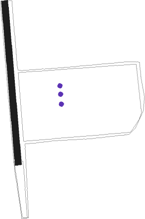
Sarasota - Schwartz Farms Inc
Airport details
| Country | United States of America |
| State | Florida |
| Region | |
| Airspace | Miami Oceanic Ctr |
| Municipality | Sarasota County |
| Elevation | 53ft (16m) |
| Timezone | GMT -5 |
| Coordinates | 27.34675, -82.31761 |
| Magnetic var | |
| Type | land |
| Available since | X-Plane v10.40 |
| ICAO code | 4FL8 |
| IATA code | n/a |
| FAA code | 4FL8 |
Communication
Nearby Points of Interest:
Miakka School House
-Dr. C. B. Wilson House
-Bee Ridge Woman's Club
-Atlantic Coast Line Passenger Depot
-El Patio Apartments
-Sarasota High School
-Sarasota County Courthouse
-Crisp Building
-Maine Colony Historic District
-Bacheller-Brewer Model Home Estate
-Dr. Walter Kennedy House
-Southwick-Harmon House
-Laurel Park Historic District
-Sarasota MRA
-South Side School
-Rigby's La Plaza Historic District
-Downtown Sarasota Historic District
-Hilton Leech House and Amagansett Art School
-Scott Commercial Building
-United States Post Office–Federal Building
-Sarasota Herald Building
-City Waterworks, Sarasota
-H. B. William House
-Appleby Building
-Worth's Block
Runway info
| Runway 18 / 36 | ||
| length | 662m (2172ft) | |
| bearing | 180° / 360° | |
| width | 27m (90ft) | |
| surface | grass | |
Nearby beacons
| code | identifier | dist | bearing | frequency |
|---|---|---|---|---|
| SRQ | SARASOTA VOR/DME | 13.6 | 284° | 117 |
| PGD | PUNTA GORDA VOR | 31.1 | 143° | 110.20 |
| MCF | MACDILL (TAMPA) TACAN | 32.6 | 339° | 111 |
| PIE | SAINT PETERSBURG VORTAC | 38.9 | 327° | 116.40 |
| LAL | LAKELAND VORTAC | 41.6 | 25° | 116 |
| PI | CAPOK(ST PETERSBURG-CLEARWATER NDB | 44 | 329° | 360 |
| TP | COSME (TAMPA) NDB | 45.7 | 344° | 368 |
| FM | CALOO (FORT MYERS) NDB | 53.6 | 156° | 341 |
| RSW | LEE COUNTY (FORT MYERS) VORTAC | 56.9 | 146° | 111.80 |
| LBV | LA BELLE VORTAC | 58.5 | 119° | 110.40 |
Disclaimer
The information on this website is not for real aviation. Use this data with the X-Plane flight simulator only! Data taken with kind consent from X-Plane 12 source code and data files. Content is subject to change without notice.
