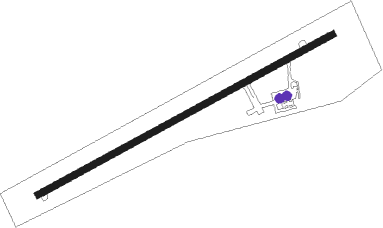
Woodsfield - Monroe Co
Airport details
| Country | United States of America |
| State | Ohio |
| Region | K5 |
| Airspace | Cleveland Ctr |
| Municipality | Center Township |
| Elevation | 1194ft (364m) |
| Timezone | GMT -5 |
| Coordinates | 39.77905, -81.10278 |
| Magnetic var | |
| Type | land |
| Available since | X-Plane v10.40 |
| ICAO code | 4G5 |
| IATA code | n/a |
| FAA code | n/a |
Communication
| Monroe Co CTAF/UNICOM | 122.800 |
Nearby Points of Interest:
William C. Mooney House
-Monroe Bank
-Hollister-Parry House
-Monroe County Courthouse
-Frederick Kindleberger Stone House and Barn
-Salem Church
-Samuel Danford Farm
-Barnesville Baltimore and Ohio Railroad Depot
-Barnesville Petroglyph
-War Memorial Building
-Sistersville City Hall
-Wells-Schaff House
-James Kinney Farmstead
-New Martinsville Downtown Historic District
-E. A. Durham House
-Dr. Lindley Schooley House and Office
-Young-Shaw House
-Abner Williams Log House
-Tower Site
-Friendly City Building and Jail
-Waernicke-Hille House and Store
-Great Western Schoolhouse
-Moundsville Commercial Historic District
-Ferrell-Holt House
-Bennett Cockayne House
Runway info
| Runway 7 / 25 | ||
| length | 1158m (3799ft) | |
| bearing | 71° / 251° | |
| width | 23m (75ft) | |
| surface | asphalt | |
| displ threshold | 53m (174ft) / 0m (0ft) | |
Nearby beacons
| code | identifier | dist | bearing | frequency |
|---|---|---|---|---|
| AIR | BELLAIRE VOR/DME | 19.4 | 50° | 117.10 |
| JPU | PARKERSBURG VOR/DME | 23.8 | 219° | 108.60 |
| CFX | CADIZ NDB | 27.7 | 11° | 239 |
| CTW | DME | 32 | 320° | 111.80 |
| PK | VERSI (PARKERSBURG) NDB | 36.1 | 216° | 388 |
| ZZV | ZANESVILLE VOR/DME | 37.6 | 282° | 114.95 |
| HLG | WHEELING VOR/DME | 37.9 | 48° | 112.20 |
| CKB | CLARKSBURG VOR/DME | 49.9 | 122° | 112.60 |
| BSV | BRIGGS VOR/DME | 59.6 | 341° | 112.40 |
| MMJ | (PITTSBURGH) DME | 59.6 | 52° | 112 |
Instrument approach procedures
| runway | airway (heading) | route (dist, bearing) |
|---|---|---|
| RW25 | CERER (217°) | CERER ZUPEN (8mi, 150°) 3000ft |
| RW25 | GALLS (268°) | GALLS ZELTU (25mi, 276°) 3900ft KIVGE (8mi, 277°) 3400ft ZUPEN (8mi, 251°) 3000ft |
| RW25 | RANDE (311°) | RANDE DIWUV (15mi, 350°) 3700ft ZUPEN (8mi, 330°) 3000ft |
| RW25 | WISKE (231°) | WISKE KIVGE (14mi, 195°) 3400ft ZUPEN (8mi, 251°) 3000ft |
| RW25 | ZUPEN (251°) | ZUPEN 3000ft |
| RNAV | ZUPEN 3000ft YOSUY (5mi, 251°) 3000ft COXOB (3mi, 251°) 1960ft 4G5 (3mi, 251°) 1230ft (4995mi, 116°) 1900ft ZUPEN (4986mi, 296°) 3000ft ZUPEN (turn) |
Disclaimer
The information on this website is not for real aviation. Use this data with the X-Plane flight simulator only! Data taken with kind consent from X-Plane 12 source code and data files. Content is subject to change without notice.
