Columbia Station - Columbia
Airport details
| Country | United States of America |
| State | Ohio |
| Region | K5 |
| Airspace | Cleveland Ctr |
| Municipality | Columbia Township |
| Elevation | 812ft (247m) |
| Timezone | GMT -5 |
| Coordinates | 41.31881, -81.96017 |
| Magnetic var | |
| Type | land |
| Available since | X-Plane v10.40 |
| ICAO code | 4G8 |
| IATA code | n/a |
| FAA code | n/a |
Communication
| Columbia CTAF/UNICOM | 122.800 |
Nearby Points of Interest:
John and Maria Adams House
-Baldwin–Wallace College South Campus Historic District
-Buehl House
-Baldwin-Wallace College North Campus Historic District
-First Universalist Church of Olmsted
-Rocket Engine Test Facility
-Zero Gravity Research Facility
-Elyria Elks Club
-Old St. John's Church
-Wilbur Cahoon House
-Avon Isle
-Bay View Hospital
-Aaron Aldrich House
-John M. Annis House
-Rocky River Bridge
-John Mercer Langston House
-Medina Masonic Temple and Medina Theater
-Wilson Bruce Evans House
-Oberlin Lake Shore and Michigan Southern Station
-Amherst Town Hall
-Reamer Barn
-Eagles Building
-Lorain Fire Station No. 1
-Carlos Avery House
-Archwood Avenue Historic District
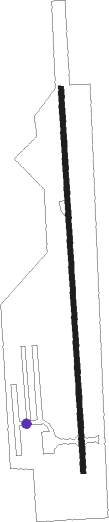
Runway info
| Runway 18 / 36 | ||
| length | 962m (3156ft) | |
| bearing | 181° / 1° | |
| width | 12m (40ft) | |
| surface | asphalt | |
Nearby beacons
| code | identifier | dist | bearing | frequency |
|---|---|---|---|---|
| DJB | DRYER VOR/DME | 9.4 | 281° | 113.60 |
| BF | TABEY (CLEVELAND) NDB | 22.9 | 57° | 248 |
| AK | AKRON NDB | 29.8 | 114° | 362 |
| LQL | LAKELAND (WILLOUGHBY) NDB | 34 | 58° | 263 |
| ACO | AKRON VOR/DME | 36.5 | 106° | 114.40 |
| CXR | CHARDON VOR/DME | 37.8 | 76° | 112.70 |
| MFD | MANSFIELD VORTAC | 39.3 | 234° | 108.80 |
| MF | MANNS (MANSFIELD) NDB | 39.8 | 221° | 372 |
| BSV | BRIGGS VOR/DME | 42.1 | 138° | 112.40 |
| PCW | PORT CLINTON NDB | 42.6 | 282° | 423 |
| QG | WINDSOR NDB | 72.2 | 318° | 353 |
Disclaimer
The information on this website is not for real aviation. Use this data with the X-Plane flight simulator only! Data taken with kind consent from X-Plane 12 source code and data files. Content is subject to change without notice.