Bishopville - Lee Co Butters Field
Airport details
| Country | United States of America |
| State | South Carolina |
| Region | K7 |
| Airspace | Jacksonville Ctr |
| Municipality | Lee County |
| Elevation | 209ft (64m) |
| Timezone | GMT -5 |
| Coordinates | 34.24449, -80.23603 |
| Magnetic var | |
| Type | land |
| Available since | X-Plane v10.40 |
| ICAO code | 52J |
| IATA code | n/a |
| FAA code | n/a |
Communication
| Lee Co Butters Field CTAF | 122.900 |
Nearby Points of Interest:
Spencer House
-The Manor
-William Apollos James House
-William Rogers House
-Lee County Courthouse
-James Carnes House
-Thomas Fraser House
-Lydia Plantation
-Mt. Zion Presbyterian Church
-Ashwood School Gymnasium and Auditorium
-Thomas E. Hart House
-Robert R. Coker House
-Paul H. Rogers House
-Hartsville Armory
-E. W. Cannon House and Store
-Wade Hampton Hicks House
-A.M. McNair House
-Hartsville Passenger Station
-Hartsville Post Office
-J. L. Coker Company Building
-Hartsville Community Center-Hartsville Community Market
-John L. Hart House (Hartsville, South Carolina)
-J.B. Gilbert House
-Davidson Hall, Coker College
-Memorial Hall
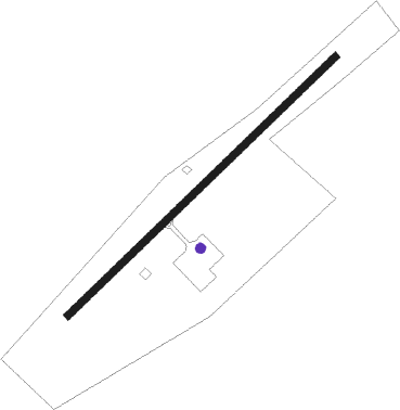
Runway info
| Runway 6 / 24 | ||
| length | 976m (3202ft) | |
| bearing | 56° / 236° | |
| width | 18m (60ft) | |
| surface | asphalt | |
Nearby beacons
| code | identifier | dist | bearing | frequency |
|---|---|---|---|---|
| HVS | HARTSVILLE NDB | 11.3 | 36° | 341 |
| SMS | SUMTER NDB | 16.4 | 206° | 252 |
| FL | ALCOT (FLORENCE) NDB | 19.5 | 100° | 335 |
| SSC | SHAW (SUMTER) TACAN | 19.6 | 221° | 110.10 |
| UDG | DARLINGTON NDB | 21 | 60° | 245 |
| CTF | CHESTERFIELD VOR/DME | 24.4 | 355° | 108.20 |
| FLO | FLORENCE VORTAC | 28.7 | 91° | 115.20 |
| CFY | EVANS (LAKE CITY) NDB | 33 | 130° | 420 |
| BES | BENNETTSVILLE NDB | 33.6 | 53° | 230 |
| MMT | MC ENTIRE (COLUMBIA) VORTAC | 34.1 | 241° | 113.20 |
| MNI | MANNING NDB | 39.4 | 177° | 381 |
| LKR | LANCASTER NDB | 42.1 | 308° | 400 |
| DLC | DILLON NDB | 44.7 | 77° | 274 |
| CAE | COLUMBIA VORTAC | 46.8 | 245° | 114.70 |
| VAN | VANCE VORTAC | 47.4 | 195° | 110.40 |
| ME | MAXTN (MAXTON) NDB | 48.9 | 58° | 257 |
| UZ | RALLY (ROCK HILL) NDB | 56.9 | 307° | 227 |
| DCM | CHESTER NDB | 57.7 | 299° | 220 |
| PHH | ANDREWS NDB | 59.3 | 138° | 255 |
| SDZ | SANDHILLS (SOUTHERN PINES VORTAC | 66.5 | 34° | 111.80 |
| CLT | CHARLOTTE VOR/DME | 66.8 | 323° | 115 |
| GHJ | STONIA (GASTONIA) NDB | 72.8 | 316° | 260 |
Disclaimer
The information on this website is not for real aviation. Use this data with the X-Plane flight simulator only! Data taken with kind consent from X-Plane 12 source code and data files. Content is subject to change without notice.