Winn - Woodruff Lake
Airport details
| Country | United States of America |
| State | Michigan |
| Region | |
| Airspace | Chicago Ctr |
| Municipality | Broomfield Township |
| Elevation | 938ft (286m) |
| Timezone | GMT -5 |
| Coordinates | 43.55449, -84.98595 |
| Magnetic var | |
| Type | land |
| Available since | X-Plane v10.40 |
| ICAO code | 53W |
| IATA code | n/a |
| FAA code | 53W |
Communication
Nearby Points of Interest:
Mount Pleasant Indian Industrial Boarding School
-Michigan Condensed Milk Factory
-Mount Pleasant Downtown Historic District
-Doughty House (Mount Pleasant, Michigan)
-Sherman City Union Church
-Lincoln Road–Pine River Bridge
-MacLachlan Sanitarium
-Giles Gilbert House
-Alma Downtown Historic District
-Wright Opera House
-George and Martha Hitchcock House
-Ithaca Downtown Historic District
-Gratiot County Courthouse
-Nisbett Building
-Fairman Building
-Greenville Downtown Historic District
-Elk Rapids Township Hall
-St. John the Baptist Catholic Church Complex
-Pere Marquette Railway Belding Depot
-Alvah N. Belding Memorial Library
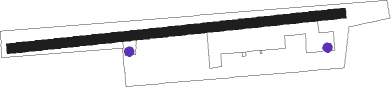
Runway info
| Runway 09 / 27 | ||
| length | 1125m (3691ft) | |
| bearing | 89° / 269° | |
| width | 32m (105ft) | |
| surface | grass | |
| displ threshold | 104m (341ft) / 79m (259ft) | |
Nearby beacons
| code | identifier | dist | bearing | frequency |
|---|---|---|---|---|
| MOP | MOUNT PLEASANT VOR/DME | 11.5 | 75° | 110.60 |
| HIC | WHITE CLOUD VOR/DME | 31.8 | 272° | 117.60 |
| MB | OLSTE (SAGINAW) NDB | 35.5 | 97° | 257 |
| MBS | SAGINAW VOR/DME | 39.5 | 91° | 112.90 |
| GR | KNOBS (GRAND RAPIDS) NDB | 43.1 | 211° | 263 |
| MA | WEXOR (CADILLAC) NDB | 47.6 | 321° | 336 |
| VIO | VICTORY VOR/DME | 51.2 | 214° | 115.95 |
Disclaimer
The information on this website is not for real aviation. Use this data with the X-Plane flight simulator only! Data taken with kind consent from X-Plane 12 source code and data files. Content is subject to change without notice.