Troy - Rensselaer County
Airport details
| Country | United States of America |
| State | New York |
| Region | |
| Airspace | Boston Ctr |
| Municipality | Town of Poestenkill |
| Elevation | 438ft (134m) |
| Timezone | GMT -5 |
| Coordinates | 42.69500, -73.58150 |
| Magnetic var | |
| Type | land |
| Available since | X-Plane v10.40 |
| ICAO code | 5B7 |
| IATA code | n/a |
| FAA code | 5B7 |
Communication
Nearby Points of Interest:
Garfield School
-Little Red Schoolhouse
-Esek Bussey Firehouse
-West Hall
-Fire Alarm, Telegraph and Police Signaling Building
-Craver Farmstead
-DeFreest Homestead
-Pumpkin House
-United States Post Office
-Central Troy Historic District
-W. & L. E. Gurley Building
-Ilium Building
-Northern River Street Historic District
-Burden Ironworks Office Building
-National State Bank Building
-McCarthy Building
-John Carner Jr. House
-Sharpe Homestead and Cemetery
-St. Mark's Episcopal Church
-Haskell School
-John Evert Van Alen House
-Watervliet Arsenal
-Iron Building
-Lansingburgh Academy
-Trinity Church Lansingburgh
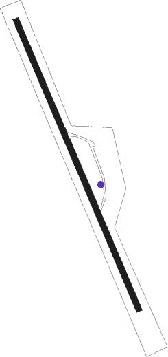
Runway info
| Runway 18 / 36 | ||
| length | 799m (2621ft) | |
| bearing | 155° / 335° | |
| width | 15m (50ft) | |
| surface | asphalt | |
Nearby beacons
| code | identifier | dist | bearing | frequency |
|---|---|---|---|---|
| ALB | ALBANY VORTAC | 10.2 | 283° | 115.30 |
| AL | HAWKY (ALBANY) NDB | 12.4 | 298° | 219 |
| HEU | HUNTER (SCHENECTADY) NDB | 18.2 | 294° | 356 |
| CAM | CAMBRIDGE VOR/DME | 20.7 | 38° | 115 |
| PFH | PHILMONT (HUDSON) NDB | 27.2 | 198° | 272 |
| GF | GANSE (GLENS FALLS) NDB | 33.6 | 358° | 209 |
| CTR | CHESTER VOR/DME | 37 | 123° | 115.10 |
| JJH | JOHNSTOWN NDB | 37.7 | 292° | 523 |
| BAF | BARNES (WESTFIELD/SPRINGF VORTAC | 49.9 | 122° | 113 |
| PWL | PAWLING (POUGHKEEPSIE) VOR/DME | 55.5 | 181° | 114.30 |
| RUT | DME | 57 | 37° | 111 |
Disclaimer
The information on this website is not for real aviation. Use this data with the X-Plane flight simulator only! Data taken with kind consent from X-Plane 12 source code and data files. Content is subject to change without notice.