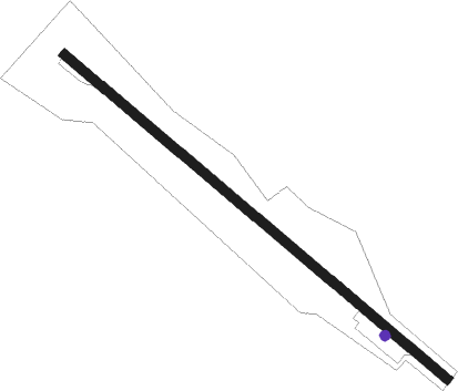
Decatur - Crystal Lake
Airport details
| Country | United States of America |
| State | Arkansas |
| Region | K4 |
| Airspace | Memphis Ctr |
| Municipality | Decatur |
| Elevation | 1178ft (359m) |
| Timezone | GMT -6 |
| Coordinates | 36.34361, -94.44483 |
| Magnetic var | |
| Type | land |
| Available since | X-Plane v11.51r1 |
| ICAO code | 5M5 |
| IATA code | n/a |
| FAA code | n/a |
Communication
| Crystal Lake CTAF/UNICOM | 122.800 |
| Crystal Lake RAZORBACK Approach/Departure | 121.725 |
| Crystal Lake RAZORBACK Approach/Departure | 121.000 |
Nearby Points of Interest:
Bolin Barn and Smokehouse
-Kindley House
-Railroad Cottage
-Mitchell-Ward House
-Mitchell House
-Bank of Gentry
-Carpenter Building
-Carl House
-Wasson House
-Coon Creek Bridge
-Coats School
-Banks House
-Shiloh House
-Sulphur Springs Old School Complex Historic District
-Jones House
-Sulphur Springs Park Reserve
-Gailey Hollow Farmstead
-Wee Pine Knot
-Alden House
-Adar House
-Council Grove Methodist Church
-Rife Farmstead
-House at 305 E. Ashley
-Connelly-Harrington House
-Bratt-Smiley House
Runway info
| Runway 13 / 31 | ||
| length | 1178m (3865ft) | |
| bearing | 129° / 309° | |
| width | 23m (75ft) | |
| surface | asphalt | |
Nearby beacons
| code | identifier | dist | bearing | frequency |
|---|---|---|---|---|
| SLG | SILOAM SPRINGS NDB | 9.5 | 196° | 284 |
| RZC | RAZORBACK (FAYETTEVILLE) VORTAC | 16.7 | 107° | 116.40 |
| EOS | NEOSHO VOR/DME | 29.9 | 1° | 117.30 |
| JL | LUNNS (JOPLIN) NDB | 51.9 | 352° | 344 |
| FSM | FORT SMITH VORTAC | 57.9 | 170° | 110.40 |
| OSW | OSWEGO VOR/DME | 61 | 317° | 117.60 |
Instrument approach procedures
| runway | airway (heading) | route (dist, bearing) |
|---|---|---|
| RW13 | EOS (181°) | EOS OSUYA (19mi, 201°) 3000ft HUMTI (5mi, 230°) 3000ft |
| RW13 | PRYOR (81°) | PRYOR EGOYI (29mi, 69°) 3000ft HUMTI (5mi, 50°) 3000ft |
| RW13 | RZC (287°) | RZC HUMTI (28mi, 295°) 3000ft HUMTI (turn) 3000ft |
| RNAV | HUMTI 3000ft RIROY (6mi, 128°) 3000ft 5M5 (6mi, 128°) 1194ft (5620mi, 111°) 1580ft HUMTI (5628mi, 291°) 3000ft HUMTI (turn) |
Disclaimer
The information on this website is not for real aviation. Use this data with the X-Plane flight simulator only! Data taken with kind consent from X-Plane 12 source code and data files. Content is subject to change without notice.
