Wallace - Wallace Muni
Airport details
| Country | United States of America |
| State | Nebraska |
| Region | |
| Airspace | Denver Ctr |
| Municipality | Wallace |
| Elevation | 3101ft (945m) |
| Timezone | GMT -6 |
| Coordinates | 40.83223, -101.16405 |
| Magnetic var | |
| Type | land |
| Available since | X-Plane v10.40 |
| ICAO code | 64V |
| IATA code | n/a |
| FAA code | 64V |
Communication
| Wallace Muni CTAF | 122.900 |
Nearby Points of Interest:
Johnston Memorial Building
-St. John's Evangelical Lutheran German Church and Cemetery
-Sutherland State Aid Bridge
-Grant Commercial Historic District
-Texas Trail Stone Corral
-Perkins County Courthouse
-Lincoln County Courthouse
-Buffalo Bill Ranch
-Chase County Courthouse
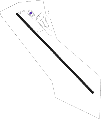
Runway info
| Runway 13 / 31 | ||
| length | 853m (2799ft) | |
| bearing | 133° / 313° | |
| width | 15m (50ft) | |
| surface | asphalt | |
| displ threshold | 122m (400ft) / 0m (0ft) | |
Nearby beacons
| code | identifier | dist | bearing | frequency |
|---|---|---|---|---|
| LBF | NORTH PLATTE VOR/DME | 22.9 | 63° | 117.40 |
| HCT | HAYES CENTER VORTAC | 25.2 | 148° | 117.70 |
| GGF | GRANT NDB | 25.8 | 274° | 359 |
| LB | PANBE (NORTH PLATTE) NDB | 30.3 | 68° | 416 |
| SAE | SEARLE (OGALLALA) VOR/DME | 32.6 | 295° | 110.20 |
| MCK | MC COOK VOR/DME | 45.8 | 138° | 115.30 |
Disclaimer
The information on this website is not for real aviation. Use this data with the X-Plane flight simulator only! Data taken with kind consent from X-Plane 12 source code and data files. Content is subject to change without notice.