Utica/frankfort - Frankfort-highland
Airport details
| Country | United States of America |
| State | New York |
| Region | |
| Airspace | Boston Ctr |
| Municipality | Town of Frankfort |
| Elevation | 1325ft (404m) |
| Timezone | GMT -5 |
| Coordinates | 43.01819, -75.17388 |
| Magnetic var | |
| Type | land |
| Available since | X-Plane v10.40 |
| ICAO code | 6B4 |
| IATA code | n/a |
| FAA code | 6B4 |
Communication
Nearby Points of Interest:
Balloon Farm
-Utica Parks and Parkway Historic District
-Frankfort Town Hall
-Roscoe Conkling House
-Utica Public Library
-Millar-Wheeler House
-Thomas Richardson House
-Hurd & Fitzgerald Building
-Doyle Hardware Building
-Fort Schuyler Club Building
-Utica Daily Press Building
-John C. Hieber Building
-Alexander Pirnie Federal Building
-Lower Genesee Street Historic District
-Palatine German Frame House
-United States Post Office
-Remington Stables
-Utica Psychiatric Center
-Bonfoy–Barstow House
-Whitestown Town Hall
-The Reformed Church
-Herkimer County Jail
-Herkimer County Courthouse
-Herkimer County Historical Society
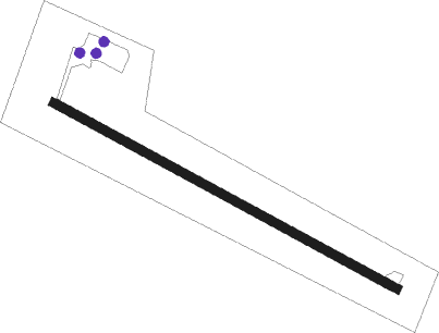
Runway info
| Runway 13 / 31 | ||
| length | 839m (2753ft) | |
| bearing | 115° / 295° | |
| width | 18m (60ft) | |
| surface | asphalt | |
| displ threshold | 61m (200ft) / 63m (207ft) | |
Nearby beacons
| code | identifier | dist | bearing | frequency |
|---|---|---|---|---|
| UCA | UTICA TACAN | 0.6 | 48° | 111.20 |
| GGT | GEORGETOWN TACAN | 31.8 | 251° | 117.80 |
| RKA | ROCKDALE VOR/DME | 33.2 | 187° | 112.60 |
| JJH | JOHNSTOWN NDB | 37 | 91° | 523 |
| DNY | DE LANCEY VOR/DME | 51.3 | 166° | 112.10 |
| HNK | HANCOCK VOR/DME | 57.7 | 188° | 116.80 |
| CFB | BINGHAMTON VOR/DME | 66.9 | 228° | 112.20 |
| ART | WATERTOWN VORTAC | 68.2 | 316° | 109.80 |
Disclaimer
The information on this website is not for real aviation. Use this data with the X-Plane flight simulator only! Data taken with kind consent from X-Plane 12 source code and data files. Content is subject to change without notice.