Stow - Minute Man Air Field
Airport details
| Country | United States of America |
| State | Massachusetts |
| Region | |
| Airspace | Boston Ctr |
| Municipality | Stow |
| Elevation | 268ft (82m) |
| Timezone | GMT -5 |
| Coordinates | 42.45754, -71.52015 |
| Magnetic var | |
| Type | land |
| Available since | X-Plane v10.40 |
| ICAO code | 6B6 |
| IATA code | n/a |
| FAA code | 6B6 |
Communication
| Minute Man Air Field CTAF/Unicom | 122.800 |
Nearby Points of Interest:
Tenney Homestead
-Brown-Stow House
-Walcott-Whitney House
-Levi Wetherbee Farm
-Hapgood House
-Boxborough Old Town Center
-Whitcomb Inn and Farm
-Jones Tavern
-Faulkner House
-Exchange Hall
-Randall-Hale Homestead
-Pan Historic District
-Acton High School
-Jonathan and Simon Hosmer House
-Frederick Fiske and Gretchen Osgood Warren House
-Pan Burying Ground
-Harvard Center Historic District
-Bolton Center Historic District
-Acton Centre Historic District
-Felton Street School
-Goodale Homestead
-Still River Baptist Church
-Harvard Shaker Village Historic District
-John Robbins House
-Damon Mill
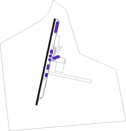
Runway info
| Runway 3 / 21 | ||
| length | 842m (2762ft) | |
| bearing | 22° / 202° | |
| width | 15m (48ft) | |
| surface | asphalt | |
Nearby beacons
| code | identifier | dist | bearing | frequency |
|---|---|---|---|---|
| BOS | BOSTON VOR/DME | 24.2 | 101° | 112.70 |
| GDM | GARDNER VOR/DME | 24.4 | 279° | 110.60 |
| MJ | FITZY (MANCHESTER) NDB | 24.4 | 359° | 209 |
| LWM | DME | 25.3 | 56° | 112.50 |
| MHT | MANCHESTER VOR/DME | 25.5 | 20° | 114.40 |
| OW | STOGE (NORWOOD) NDB | 26.7 | 131° | 397 |
| PUT | PUTNAM VOR/DME | 33.4 | 213° | 117.40 |
| EEN | DME | 39.6 | 294° | 109.40 |
| CO | EPSOM (CONCORD) NDB | 39.8 | 6° | 216 |
| PVD | PROVIDENCE VOR/DME | 44.2 | 173° | 115.60 |
| CON | CONCORD VOR/DME | 45.8 | 356° | 112.90 |
| PSM | (PORTSMOUTH) DME | 48.3 | 48° | 116.50 |
| ESG | ROLLINS (ROLLINSFORD) NDB | 55 | 42° | 260 |
| ORW | NORWICH VOR/DME | 58.1 | 208° | 110 |
| SF | SANFD (SANFORD) NDB | 60.6 | 38° | 349 |
| CNH | CLAREMONT NDB | 66.3 | 317° | 233 |
| ENE | KENNEBUNK VOR/DME | 70.4 | 43° | 117.10 |
Instrument approach procedures
| runway | airway (heading) | route (dist, bearing) |
|---|---|---|
| RW21 | GDM (99°) | GDM AXITE (23mi, 78°) 2700ft ERIGY (5mi, 102°) 2000ft |
| RW21 | MHT (200°) | MHT ERIGY (15mi, 200°) 2000ft ERIGY (turn) 2000ft |
| RW21 | ZUPRO (230°) | ZUPRO ERIGY (5mi, 282°) 2000ft |
| RNAV | ERIGY 2000ft EGORE (5mi, 201°) 2000ft 6B6 (6mi, 201°) 308ft (4593mi, 121°) 670ft ERIGY (4592mi, 301°) 2000ft ERIGY (turn) |
Disclaimer
The information on this website is not for real aviation. Use this data with the X-Plane flight simulator only! Data taken with kind consent from X-Plane 12 source code and data files. Content is subject to change without notice.