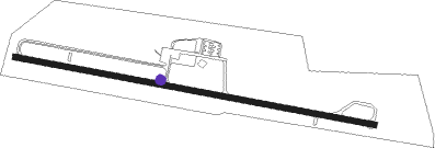
Springfield
Airport details
| Country | United States of America |
| State | Kentucky |
| Region | K5 |
| Airspace | Indianapolis Ctr |
| Municipality | Washington County |
| Elevation | 866ft (264m) |
| Timezone | GMT -5 |
| Coordinates | 37.63348, -85.24184 |
| Magnetic var | |
| Type | land |
| Available since | X-Plane v10.40 |
| ICAO code | 6I2 |
| IATA code | n/a |
| FAA code | n/a |
Communication
| Springfield AWOS-3 | 119.725 |
| Springfield CTAF/UNICOM | 122.800 |
Nearby Points of Interest:
William Blackwell House
-Washington County Courthouse
-Johnson's Chapel AME Church
-St. Dominic's Catholic Church
-Perryville Battlefield State Historic Site
-St. Thomas Roman Catholic Church and Howard-Flaget House
-My Old Kentucky Home State Park
-Old Talbott Tavern
-Nelson County Jail
-Bardstown Historic District
-Old L & N Station
-Spalding Hall
-Basilica of St. Joseph Proto-Cathedral
-Ben Johnson House
-Louisville and Nashville Combine Car Number 665
-Louisville and Nashville Railroad 152
-Newell B. McClaskey House
-Campbellsville Historic Commercial District
-Merchant Tower
-Knob Creek Farm
-Beaumont Avenue Residential District
-St. Philip's Episcopal Church
-St. Peter's AME Church
-First Christian Church
-Carnegie Library
Nearby beacons
| code | identifier | dist | bearing | frequency |
|---|---|---|---|---|
| EWO | NEW HOPE VOR/DME | 20.6 | 270° | 110.80 |
| DVK | GOODALL (DANVILLE) NDB | 22.9 | 97° | 311 |
| IIU | LOUISVILLE VORTAC | 32.4 | 324° | 114.80 |
| LE | BLAYD (LEXINGTON) NDB | 34.8 | 59° | 242 |
| LK | LAANG (LOUISVILLE) NDB | 35.8 | 323° | 414 |
| FFT | FRANKFORT VOR | 36.5 | 31° | 109.40 |
| FTK | FORT KNOX VOR/DME | 38.3 | 291° | 109.60 |
| BQM | (LOUISVILLE) DME | 41 | 325° | 112.20 |
| HYK | LEXINGTON VOR/DME | 41.6 | 67° | 112.60 |
| GN | BRIDL (LEXINGTON) NDB | 45.6 | 56° | 340 |
| CDX | CUMBERLAND RIVER (SOMERSET) NDB | 46.7 | 139° | 388 |
| JV | CATCH (JEFFERSONVILLE) NDB | 55.6 | 329° | 331 |
Instrument approach procedures
| runway | airway (heading) | route (dist, bearing) |
|---|---|---|
| RW11 | WIGRU (102°) | WIGRU 4000ft |
| RNAV | WIGRU 4000ft KITCE (7mi, 102°) 2500ft ZEMOV (4mi, 102°) 1360ft 6I2 (2mi, 102°) 859ft (5179mi, 114°) 1104ft WOBIL (5167mi, 294°) 4000ft WOBIL (turn) | |
| RW29 | WOBIL (282°) | WOBIL 4000ft |
| RNAV | WOBIL 4000ft YULUN (7mi, 282°) 2500ft ZERET (3mi, 282°) 1480ft 6I2 (2mi, 282°) 924ft (5179mi, 114°) 1152ft WIGRU (5191mi, 294°) 4000ft WIGRU (turn) |
Disclaimer
The information on this website is not for real aviation. Use this data with the X-Plane flight simulator only! Data taken with kind consent from X-Plane 12 source code and data files. Content is subject to change without notice.
