Saluda - Saluda County
Airport details
| Country | United States of America |
| State | South Carolina |
| Region | K7 |
| Airspace | Jacksonville Ctr |
| Municipality | Saluda County |
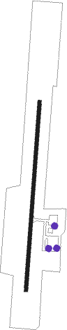
| Elevation | 555ft (169m) |
| Timezone | GMT -5 |
| Coordinates | 33.92680, -81.79462 |
| Magnetic var | |
| Type | land |
| Available since | X-Plane v10.40 |
| ICAO code | 6J4 |
| IATA code | n/a |
| FAA code | n/a |
Communication
| Saluda County CTAF | 122.900 |
Nearby Points of Interest:
Marsh-Johnson House
-Old Strother Place
-Whitehall
-Saluda Theatre
-Ridge Hill High School
-Edgefield Historic District
-Bonham House
-Stevens-Dorn Farmstead
-Cedar Grove
-Blocker House
-Marshfield (Trenton, South Carolina)
-Darby Plantation
-Rawl-Couch House
-Simon Bouknight House
-McKendree Mitchell House
-Cartledge House
-J.B. Holman House
-Broadus Edwards House
-John Jacob Rawl House
-A.C. Jones House
-Southern Railway Depot
-Hartley House
-Old Batesburg Grade School
-Old Batesburg-Leesville High School
-D. D. D. Barr House
Nearby beacons
| code | identifier | dist | bearing | frequency |
|---|---|---|---|---|
| AIK | AIKEN NDB | 17.5 | 157° | 347 |
| IRQ | COLLIERS VORTAC | 22.5 | 239° | 113.90 |
| EOE | ENOREE (NEWBERRY) NDB | 24.3 | 22° | 278 |
| GIW | CORONACA (GREENWOOD) NDB | 24.4 | 318° | 239 |
| GRD | GREENWOOD VORTAC | 26.4 | 312° | 115.50 |
| CA | MURRY (COLUMBIA) NDB | 27.5 | 86° | 362 |
| EMR | EMORY (AUGUSTA) NDB | 29.6 | 204° | 385 |
| CAE | COLUMBIA VORTAC | 37.1 | 95° | 114.70 |
| AG | BUSHE (AUGUSTA) NDB | 39.1 | 193° | 233 |
| UOT | UNION COUNTY NDB | 46 | 11° | 326 |
| AA | CEDAR (THOMSON) NDB | 47.2 | 244° | 341 |
| MMT | MC ENTIRE (COLUMBIA) VORTAC | 49.4 | 90° | 113.20 |
| GY | DYANA (GREENVILLE) NDB | 56 | 320° | 338 |
| ELW | ELECTRIC CITY (ANDERSON) VORTAC | 57.3 | 296° | 108.60 |
| GM | JUDKY (GREENVILLE) NDB | 58.1 | 327° | 521 |
| DCM | CHESTER NDB | 59.3 | 35° | 220 |
| ALD | ALLENDALE VOR | 60.4 | 151° | 116.70 |
| LKR | LANCASTER NDB | 66.6 | 50° | 400 |
| UZ | RALLY (ROCK HILL) NDB | 67.8 | 37° | 227 |
Instrument approach procedures
| runway | airway (heading) | route (dist, bearing) |
|---|---|---|
| RW01 | FONLU (10°) | FONLU 2500ft |
| RW01 | JIVPO (342°) | JIVPO 2500ft FONLU (5mi, 277°) 2500ft |
| RW01 | TEPDE (37°) | TEPDE 2500ft FONLU (5mi, 97°) 2500ft |
| RNAV | FONLU 2500ft CUBOK (6mi, 10°) 2200ft 6J4 (5mi, 10°) 582ft (4997mi, 113°) 940ft FONLU (4998mi, 292°) 2500ft FONLU (turn) | |
| RW19 | CIXUP (217°) | CIXUP 2500ft ODODY (5mi, 277°) 2500ft |
| RW19 | FISIK (162°) | FISIK 2500ft ODODY (5mi, 97°) 2500ft |
| RW19 | ODODY (190°) | ODODY 2500ft |
| RNAV | ODODY 2500ft AVIGY (6mi, 190°) 2200ft 6J4 (5mi, 190°) 574ft FONLU (11mi, 190°) 2500ft FONLU (turn) |
Disclaimer
The information on this website is not for real aviation. Use this data with the X-Plane flight simulator only! Data taken with kind consent from X-Plane 12 source code and data files. Content is subject to change without notice.