Brockport - Ledgedale Airpark
Airport details
| Country | United States of America |
| State | New York |
| Region | K6 |
| Airspace | Cleveland Ctr |
| Municipality | Town of Sweden |
| Elevation | 665ft (203m) |
| Timezone | GMT -5 |
| Coordinates | 43.18119, -77.91550 |
| Magnetic var | |
| Type | land |
| Available since | X-Plane v10.40 |
| ICAO code | 7G0 |
| IATA code | n/a |
| FAA code | n/a |
Communication
| Ledgedale Airpark CTAF/UNICOM | 122.700 |
| Ledgedale Airpark ROCHESTER Approach/Departure | 123.700 |
Nearby Points of Interest:
Soldiers' Memorial Tower
-Morgan–Manning House
-Edward Harrison House
-Main Street Historic District
-Clarkson Corners Historic District
-Butterfield Cobblestone House
-Spencerport Methodist Church
-Gifford–Walker Farm
-Lake Street Historic District
-Clarendon Stone Store
-Riga Academy
-Chase Cobblestone Farmhouse
-William Covert Cobblestone Farmhouse
-Curtis-Crumb Farm
-William Shirts House
-Wheatland Baptist Cemetery
-Franklin Hinchey House
-David McVean House
-Inglewood and Thurston Historic District
-Donald Mann House
-Grace Church
-Simeon Sage House
-Union Presbyterian Church
-Rochester Street Historic District
-Holy Rosary Church Complex
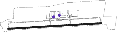
Runway info
| Runway 10 / 28 | ||
| length | 1279m (4196ft) | |
| bearing | 91° / 271° | |
| width | 23m (75ft) | |
| surface | asphalt | |
Nearby beacons
| code | identifier | dist | bearing | frequency |
|---|---|---|---|---|
| ROC | ROCHESTER VOR/DME | 11.2 | 105° | 110 |
| GEE | GENESEO VOR/DME | 22.3 | 152° | 108.20 |
| BU | KLUMP (BUFFALO) NDB | 34 | 256° | 231 |
| BUF | BUFFALO VOR/DME | 35.4 | 251° | 116.40 |
| IA | KATHI (NIAGRA FALLS) NDB | 40.6 | 266° | 329 |
| GB | PLAZZ (BUFFALO) NDB | 43.6 | 251° | 204 |
| PYA | PENN YAN NDB | 49.6 | 122° | 260 |
| ZZR | SEVERN (TRENTON) NDB | 53.8 | 18° | 317 |
| UTR | TRENTON TACAN | 58.9 | 22° | 109.70 |
| YO | DME-ILS | 61.1 | 307° | 111.35 |
| OO | OSHAWA NDB | 61.7 | 307° | 391 |
Instrument approach procedures
| runway | airway (heading) | route (dist, bearing) |
|---|---|---|
| RW28 | ROC (285°) | ROC QEBZA (4mi, 9°) 4300ft QEBZA (turn) 3500ft |
| RNAV | QEBZA 3500ft OBILY (6mi, 271°) 2200ft JEBEM (2mi, 271°) 1420ft 7G0 (3mi, 271°) 722ft (4878mi, 119°) 1060ft CESON (4881mi, 299°) CLUNG (8mi, 182°) 3500ft CLUNG (turn) 3500ft |
Disclaimer
The information on this website is not for real aviation. Use this data with the X-Plane flight simulator only! Data taken with kind consent from X-Plane 12 source code and data files. Content is subject to change without notice.