Muncie - Reese
Airport details
| Country | United States of America |
| State | Indiana |
| Region | |
| Airspace | Indianapolis Ctr |
| Municipality | Delaware County |
| Elevation | 991ft (302m) |
| Timezone | GMT -5 |
| Coordinates | 40.15539, -85.31927 |
| Magnetic var | |
| Type | land |
| Available since | X-Plane v10.40 |
| ICAO code | 7I2 |
| IATA code | n/a |
| FAA code | 7I2 |
Communication
Nearby Points of Interest:
William Henry Luick Farmhouse
-Dr. Samuel Vaughn Jump House
-Grace Keiser Maring Library
-Kirby Historic District
-Wilson Junior High School
-Emily Kimbrough Historic District
-Margaret and George Riley Jones House
-Peacock Apartments
-Masonic Temple
-Carnegie Library
-F.D. Rose Building
-Francis T. Roots Building
-W.W. Shirk Building
-Cincinnati, Richmond, & Muncie Depot
-City Hall
-Boyce Block
-J.C. Johnson House
-Goldsmith C. Gilbert Historic District
-Walnut Street Historic District
-Moore-Youse-Maxon House
-Judson Building
-Old West End Historic District
-Meeks Avenue Historic District
-Otto Carmichael House
-Wysor Heights Historic District
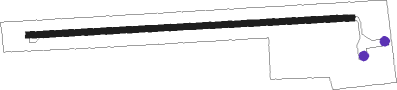
Runway info
| Runway 9 / 27 | ||
| length | 851m (2792ft) | |
| bearing | 91° / 271° | |
| width | 15m (50ft) | |
| surface | asphalt | |
Nearby beacons
| code | identifier | dist | bearing | frequency |
|---|---|---|---|---|
| JN | BALLL (MUNCIE) NDB | 1.5 | 356° | 365 |
| MI | BALLL (MUNCIE) NDB | 1.5 | 357° | 365 |
| MIE | MUNCIE VOR/DME | 5.9 | 318° | 114.40 |
| AI | VIDEO (ANDERSON) NDB | 10.1 | 246° | 394 |
| UWL | NEW CASTLE NDB | 16.5 | 180° | 385 |
| AWW | WINCHESTER NDB | 18.2 | 88° | 212 |
| SQ | PNTHR (CONNERSVILLE) NDB | 24.3 | 153° | 227 |
| MZZ | MARION VOR/DME | 26.1 | 313° | 108.60 |
| RID | RICHMOND VOR/DME | 32.6 | 130° | 110.60 |
| UMP | METROPOLITAN (INDIANAPOLIS) NDB | 36 | 253° | 338 |
| SHB | SHELBYVILLE VOR/DME | 39 | 224° | 112 |
| OKK | KOKOMO VORTAC | 40.5 | 297° | 113.50 |
| DQN | DAYTON VOR/DME | 43.1 | 99° | 114.50 |
| FV | LAREZ (INDIANAPOLIS) NDB | 46 | 247° | 349 |
| GUS | GRISSOM (PERU) VORTAC | 48.1 | 300° | 108.45 |
| HLB | BATESVILLE NDB | 48.6 | 176° | 254 |
| AT | BRUNY (DAYTON) NDB | 48.9 | 107° | 315 |
| CO | COLFA (INDIANAPOLIS) NDB | 49.8 | 240° | 232 |
| FWA | FORT WAYNE VORTAC | 49.8 | 9° | 117.80 |
| BA | CLIFS (COLUMBUS) NDB | 55.1 | 211° | 410 |
| HKF | HOOK FIELD (MIDDLETOWN) NDB | 56.3 | 127° | 239 |
| MW | ONIDA (MIDDLETOWN) NDB | 57.5 | 120° | 223 |
Disclaimer
The information on this website is not for real aviation. Use this data with the X-Plane flight simulator only! Data taken with kind consent from X-Plane 12 source code and data files. Content is subject to change without notice.