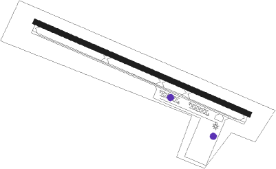
Coopers Plains - Corning Painted Post
Airport details
| Country | United States of America |
| State | New York |
| Region | K6 |
| Airspace | New York Ctr |
| Municipality | Town of Erwin |
| Elevation | 951ft (290m) |
| Timezone | GMT -5 |
| Coordinates | 42.18010, -77.12170 |
| Magnetic var | |
| Type | land |
| Available since | X-Plane v10.40 |
| ICAO code | 7N1 |
| IATA code | n/a |
| FAA code | n/a |
Communication
Nearby Points of Interest:
First Baptist Church of Painted Post
-United States Post Office
-Corning Armory
-World War Memorial Library
-Market Street Historic District
-Southside Historic District
-William Wombough House
-Maple Street Historic District
-Main Street Historic District
-Addison Village Hall
-James Ford House
-Judge John Ryon House
-Northrup Hill School District 10
-Campbell-Rumsey House
-McMaster House
-Gansevoort/East Steuben Streets Historic District
-Liberty Street Historic District
-M. J. Ward Feed Mill Complex
-Davenport Library
-Potter-Van Camp House
-Erie Freighthouse Historic District
-George W. Hallock House
-Reuben Robie House
Runway info
| Runway 14 / 32 | ||
| length | 995m (3264ft) | |
| bearing | 111° / 291° | |
| width | 23m (75ft) | |
| surface | asphalt | |
Nearby beacons
| code | identifier | dist | bearing | frequency |
|---|---|---|---|---|
| ULW | ELMIRA VOR/DME | 6.7 | 132° | 109.65 |
| ALP | ALPINE (ELMIRA) NDB | 16.2 | 81° | 245 |
| PYA | PENN YAN NDB | 28 | 8° | 260 |
| SFK | STONYFORK VOR/DME | 32 | 212° | 108.60 |
| ITH | DME | 34.9 | 65° | 111.80 |
| IT | VRNAH (ITHACA) NDB | 36.6 | 72° | 266 |
| ELZ | DME | 39.4 | 264° | 111.40 |
| CFB | BINGHAMTON VOR/DME | 43.8 | 91° | 112.20 |
| GEE | GENESEO VOR/DME | 47.7 | 317° | 108.20 |
| FQM | WILLIAMSPORT VOR/DME | 52.8 | 158° | 114.40 |
| SLT | SLATE RUN VORTAC | 55.1 | 232° | 113.90 |
| ROC | ROCHESTER VOR/DME | 61.3 | 330° | 110 |
| SYR | SYRACUSE VORTAC | 71.4 | 43° | 117 |
Disclaimer
The information on this website is not for real aviation. Use this data with the X-Plane flight simulator only! Data taken with kind consent from X-Plane 12 source code and data files. Content is subject to change without notice.
