Labelle - Williams Sky Manor
Airport details
| Country | United States of America |
| State | Florida |
| Region | |
| Airspace | Miami Oceanic Ctr |
| Municipality | Hendry County |
| Elevation | 15ft (5m) |
| Timezone | GMT -5 |
| Coordinates | 26.73855, -81.51567 |
| Magnetic var | |
| Type | land |
| Available since | X-Plane v10.40 |
| ICAO code | 7X4 |
| IATA code | n/a |
| FAA code | n/a |
Communication
Nearby Points of Interest:
Capt. Francis A. Hendry House
-Caldwell Home Place
-Old Hendry County Courthouse
-Downtown LaBelle Historic District
-Alva Consolidated Schools
-Buckingham School
-Menge-Hansen Marine Ways
-Alderman House
-Murphy-Burroughs House
-Old Lee County Courthouse
-William H. Towles House
-Casa Rio
-Jewett-Thompson House
-Moore Haven Residential Historic District
-Moore Haven Downtown Historic District
-Archbold Biological Station
-Red Barn
-Villa Bianca
-Clarence L. Babcock House
-A. C. Freeman House
-Punta Gorda Atlantic Coast Line Depot
-Old First National Bank of Punta Gorda
-Clewiston Theater
-Capt. F. Deane Duff House
-Executive House
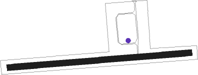
Runway info
| Runway 09 / 27 | ||
| length | 1341m (4400ft) | |
| bearing | 90° / 270° | |
| width | 46m (150ft) | |
| surface | grass | |
Nearby beacons
| code | identifier | dist | bearing | frequency |
|---|---|---|---|---|
| LBV | LA BELLE VORTAC | 8.5 | 54° | 110.40 |
| RSW | LEE COUNTY (FORT MYERS) VORTAC | 18.7 | 231° | 111.80 |
| FM | CALOO (FORT MYERS) NDB | 26.8 | 243° | 341 |
| PGD | PUNTA GORDA VOR | 27.6 | 291° | 110.20 |
| CYY | CYPRESS (NAPLES) VOR/DME | 37.8 | 204° | 108.60 |
| PHK | PAHOKEE VOR/DME | 44.2 | 87° | 115.40 |
Disclaimer
The information on this website is not for real aviation. Use this data with the X-Plane flight simulator only! Data taken with kind consent from X-Plane 12 source code and data files. Content is subject to change without notice.