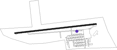
Mocksville - Twin Lakes
Airport details
| Country | United States of America |
| State | North Carolina |
| Region | |
| Airspace | Atlanta Ctr |
| Municipality | Davie County |
| Elevation | 814ft (248m) |
| Timezone | GMT -5 |
| Coordinates | 35.91478, -80.46180 |
| Magnetic var | |
| Type | land |
| Available since | X-Plane v10.40 |
| ICAO code | 8A7 |
| IATA code | n/a |
| FAA code | 8A7 |
Communication
| Twin Lakes Comms | 122.700 |
Nearby Points of Interest:
Cooleemee
-Davie County Jail
-Davie County Courthouse
-Downtown Mocksville Historic District
-Win-Mock Farm Dairy
-Philip Sowers House
-Grimes Brothers Mill
-Dr. William Rainey Holt House
-Uptown Lexington Historic District
-Lexington Memorial Hospital
-Southern Railway's Spencer Shops
-Grubb-Sigmon-Weisiger House
-Walter McCanless House
-Glenwood
-Kesler Manufacturing Co.-Cannon Mills Co. Plant No. 7 Historic District
-J. C. Price High School
-Grimes Mill
-Monroe Street School
-Ellis Street Graded School Historic District
-Centerville Historic District
-Nissen Building
-Shaver Rental Houses District
-Maxwell Chambers House
-Christ Episcopal Church
-Joseph Franklin Bland House
Nearby beacons
| code | identifier | dist | bearing | frequency |
|---|---|---|---|---|
| RU | ROVDY (SALISBURY) NDB | 10.9 | 189° | 275 |
| IN | REENO (WINSTON SALEM) NDB | 17.1 | 62° | 317 |
| GSO | GREENSBORO VORTAC | 24.8 | 75° | 116.20 |
| VU | ALLER (ALBEMARLE) NDB | 31.5 | 138° | 346 |
| BZM | BARRETTS MOUNTAIN (HICKOR VOR/DME | 37.9 | 267° | 113.75 |
| HK | TAWBA (HICKORY) NDB | 41.7 | 261° | 332 |
| LIB | LIBERTY VORTAC | 41.7 | 97° | 113 |
| HB | ALAMM NDB | 42.8 | 86° | 361 |
| SIF | SLAMMER (REIDSVILLE) NDB | 43.9 | 56° | 423 |
| UV | BALES (MARTINSVILLE) NDB | 48.3 | 39° | 396 |
| CLT | CHARLOTTE VOR/DME | 49.6 | 214° | 115 |
| JUH | ASHEE (JEFFERSON) NDB | 52 | 301° | 410 |
| GHJ | STONIA (GASTONIA) NDB | 55.1 | 224° | 260 |
| SDZ | SANDHILLS (SOUTHERN PINES VORTAC | 59.8 | 129° | 111.80 |
Instrument approach procedures
| runway | airway (heading) | route (dist, bearing) |
|---|---|---|
| RW09 | BURCH (125°) | BURCH COXOV (10mi, 132°) 3700ft ZEMPO (8mi, 177°) 3400ft WIPUS (4mi, 88°) 2400ft |
| RW09 | BZM (87°) | BZM ZEMPO (28mi, 86°) 3400ft WIPUS (4mi, 88°) 2400ft |
| RW09 | ZEMPO (88°) | ZEMPO 3400ft WIPUS (4mi, 88°) 2400ft |
| RNAV | WIPUS 2400ft JUVAP (2mi, 88°) 2200ft 8A7 (4mi, 88°) 823ft (4942mi, 114°) 1218ft ZISER (4939mi, 294°) AZELL (9mi, 110°) 3000ft AZELL (turn) |
Disclaimer
The information on this website is not for real aviation. Use this data with the X-Plane flight simulator only! Data taken with kind consent from X-Plane 12 source code and data files. Content is subject to change without notice.