Twin Mountain
Airport details
| Country | United States of America |
| State | New Hampshire |
| Region | |
| Airspace | Boston Ctr |
| Municipality | Carroll |
| Elevation | 1458ft (444m) |
| Timezone | GMT -5 |
| Coordinates | 44.26306, -71.55163 |
| Magnetic var | |
| Type | land |
| Available since | X-Plane v10.40 |
| ICAO code | 8B2 |
| IATA code | n/a |
| FAA code | 8B2 |
Communication
Nearby Points of Interest:
Crawford House Artist's Studio
-Felsengarten
-Rocks Estate
-Franconia Notch
-Lovett's by Lafayette Brook
-Abbie Greenleaf Library
-Dow Academy
-Burt-Cheney Farm
-The Frost Place
-Edward H. Lane House
-Littleton Town Building
-Waumbek Cottages Historic District
-United States Post Office and Courthouse–Littleton Main
-Tip-Top House
-Weeks Estate
-Garland Mill
-United States Post Office–Lancaster Main
-William Dennis Weeks Memorial Library
-Wilder-Holton House
-Jeremiah Hutchins Tavern
-George Washington Noyes House
-Russell-Colbath House
-Judge David Hibbard Homestead
-Brick Store
-Lee Farm
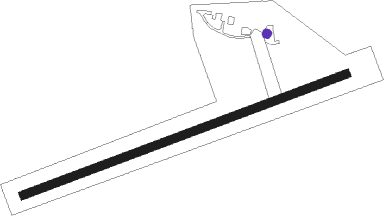
Runway info
| Runway 9 / 27 | ||
| length | 809m (2654ft) | |
| bearing | 78° / 258° | |
| width | 18m (60ft) | |
| surface | asphalt | |
Nearby beacons
| code | identifier | dist | bearing | frequency |
|---|---|---|---|---|
| GMA | MAHN (WHITEFIELD) NDB | 8.2 | 306° | 386 |
| BML | DME | 27.2 | 45° | 116.55 |
| MPV | MONTPELIER VOR/DME | 40.1 | 259° | 116.90 |
| LAH | HANOVER (LEBANON) NDB | 43.1 | 228° | 276 |
| LC | BLNAP (LACONIA) NDB | 43.6 | 179° | 328 |
| LEB | DME | 45.3 | 229° | 113.70 |
| RQM | RANGELEY NDB | 52.8 | 50° | 221 |
| SF | SANFD (SANFORD) NDB | 63.8 | 142° | 349 |
| CNH | CLAREMONT NDB | 64.3 | 223° | 233 |
| ENE | KENNEBUNK VOR/DME | 64.6 | 132° | 117.10 |
Disclaimer
The information on this website is not for real aviation. Use this data with the X-Plane flight simulator only! Data taken with kind consent from X-Plane 12 source code and data files. Content is subject to change without notice.