Cheyenne - Mignon Laird Muni
Airport details
| Country | United States of America |
| State | Oklahoma |
| Region | K4 |
| Airspace | Ft Worth Ctr |
| Municipality | Cheyenne |
| Elevation | 2083ft (635m) |
| Timezone | GMT -6 |
| Coordinates | 35.60322, -99.70300 |
| Magnetic var | |
| Type | land |
| Available since | X-Plane v10.40 |
| ICAO code | 93F |
| IATA code | n/a |
| FAA code | n/a |
Communication
| Mignon Laird Muni CTAF/UNICOM | 122.900 |
Nearby Points of Interest:
Storm House
-Hedlund Motor Company Building
-J. W. Danner House
-Sayre Rock Island Depot
-Beckham County Courthouse
-Sayre Champlin Service Station
-Sayre City Park
-Canute Service Station
-Magnolia Service Station
-Route 66 Bridge over the Chicago, Rock Island and Gulf Railroad
-Ellis County Courthouse
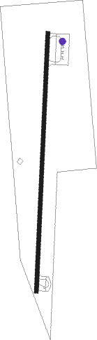
Runway info
| Runway 18 / 36 | ||
| length | 1227m (4026ft) | |
| bearing | 189° / 9° | |
| width | 18m (60ft) | |
| surface | asphalt | |
| blast zone | 61m (200ft) / 0m (0ft) | |
Nearby beacons
| code | identifier | dist | bearing | frequency |
|---|---|---|---|---|
| BZ | FOSSI (CLINTON) NDB | 26.1 | 107° | 393 |
| BFV | BURNS FLAT (CLINTON) VORTAC | 32.7 | 126° | 110 |
| MMB | MITBEE (GAGE) VORTAC | 45.2 | 347° | 115.60 |
| HBR | HOBART VORTAC | 54.2 | 139° | 111.80 |
| LTS | ALTUS VORTAC | 60.3 | 155° | 109.80 |
Disclaimer
The information on this website is not for real aviation. Use this data with the X-Plane flight simulator only! Data taken with kind consent from X-Plane 12 source code and data files. Content is subject to change without notice.